Enable Location

We need your location to show you interesting places around you

Discover nearby places

Find interesting locations and hidden gems around you

Precise directions

Get accurate directions and distances to places

Your location is never shared with other users. It's only used when you tap the location button.

Mae Sai

Log in to your account

Start exploring — it's free

Trusted by 61,437 travelers worldwide

Continue with Google
Continue with Apple
or

We will send you a code to connect

By continuing, you accept our Terms and Conditions and our Privacy Policy

Check your inbox

We've sent a pincode in your inbox. Please enter the code below.

Mae Sai, Administrative district in Chiang Rai Province, Thailand.

Description

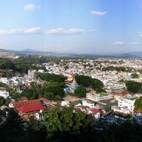
Mae Sai is an administrative district in northern Chiang Rai Province that stretches along the Myanmar border. The area is divided into several subdistricts and contains towns, villages, and important crossing points where the border region meets Thai territory.

History

The district was formed in 1939 from two communities separated from Chiang Saen and became a full district in 1950. This administrative change was part of efforts to organize the Thai borderlands.

Culture

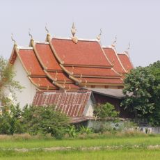
Thai and Shan traditions blend visibly through local shops, food, and crafts that reflect both cultures. Border communities here share customs and daily routines that have developed from generations of cross-border contact.

Practical

The area functions as a main crossing point between Thailand and Myanmar with a direct border bridge. Visitors should be aware of the border location and prepare appropriate documents depending on their travel plans.

Did you know?

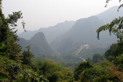
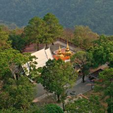
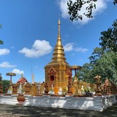
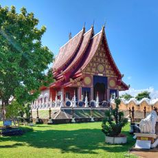
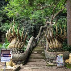
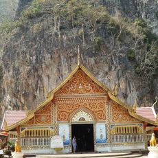
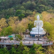
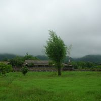
The Daen Lao mountain range borders this area with peaks like Doi Tung, topped by the ancient Wat Phra That temple. This mountain is both a natural boundary and a destination where visitors can hike and enjoy sweeping views of the border region.

Location
Elevation above the sea
377 m
Shares border with
Chiang Saen, Mae Chan, Mae Fa Luang, Tachileik District
GPS coordinates
20.42806,99.88361
Latest update
December 20, 2025 14:13

AroundUs brings together thousands of curated places, local tips, and hidden gems, enriched daily by 60,000 contributors worldwide. Discover all places nearby (Chiang Rai).

« Mae Sai - Administrative district in Chiang Rai Province, Thailand » is provided by Around Us (aroundus.com). Images and texts are derived from Wikimedia project under a Creative Commons license. You are allowed to copy, distribute, and modify copies of this page, under the conditions set by the license, as long as this note is clearly visible.

Discover hidden gems everywhere you go!

From secret cafés to breathtaking viewpoints, skip the crowded tourist spots and find places that match your style. Our app makes it easy with voice search, smart filtering, route optimization, and insider tips from travelers worldwide. Download now for the complete mobile experience.

Around Us App Screenshot

A unique approach to discovering new places

Le Figaro

All the places worth exploring

France Info

A tailor-made excursion in just a few clicks

20 Minutes

Around Us
Travel Guide & Maps
Download

Send to your phone

QR Code
1

Open the camera app on your mobile.

2

Point at the QR code with your camera. A notification will appear.

3

Tap the notification to open the link.