54 And 56, Long Street, building in Tetbury, Cotswold, Gloucestershire, UK
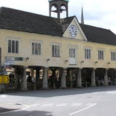
Market House
279 m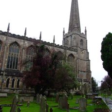
Church of St Mary the Virgin
416 m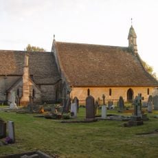
St Saviour's Church, Tetbury
138 m
The Snooty Fox
273 m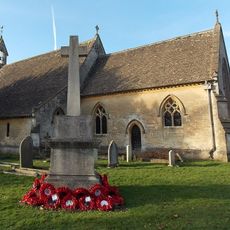
Tetbury War Memorial in the Churchyard of the Church of St Saviour
128 m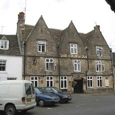
The Crown Inn
318 m
Unidentified Memorial, About 1 Metre East Of North East Path At 10 Metres From Path Crossing In Churchyard Of Church Of St Mary
393 m
Holborow Memorial, About 9 Metres From North East Corner Of Chancel In Churchyard Of Church Of St Mary
421 m
Unidentified Memorial, About 4 Metres West Of North West Path At 6 Metres From Path Crossing In Churchyard Of Church Of St Mary
384 m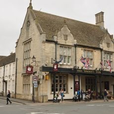
The Snooty Fox Hotel
266 m
Sloper Memorial, About 7 Metres West Of Swinerton Memorials In Churchyard Of Church Of St Mary
376 m
Hooper Memorial, About 6 Metres West Of North West Path At 5 Metres From Path Crossing In Churchyard Of Church Of St Mary
384 m
3 Memorials, Partly To Ralph Family, About 3 Metres South West Of Swinerton Memorials In Churchyard Of Church Of St Mary
376 m
Unidentified Memorial, About 10 Metres East Of West Gate In Churchyard Of Church Of St Mary
389 m
Unidentifed Memorial, About 9 Metres East Of North West Path At 21 Metres From Path Crossing In Churchyard Of Church Of St Mary
366 m
5, 13 And 15, The Chipping
297 m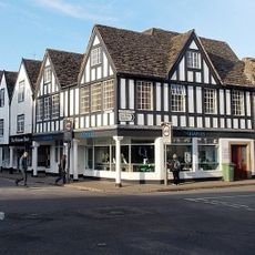
1, Long Street
247 m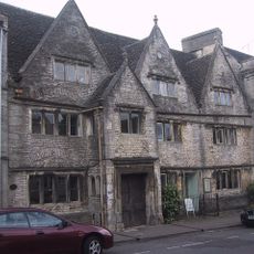
Porch House
58 m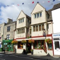
Talboys House
282 m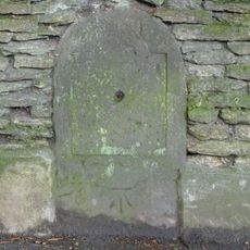
Milestone, W side of The Chipping.
214 m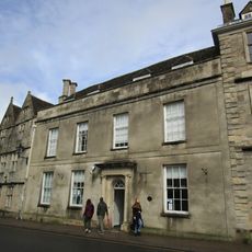
41, Long Street
96 m
Unidentified Memorial, About 14 Metres West Of Tower In Churchyard Of Church Of St Mary
392 m
Group Of 3 Unidentified Memorials, About 1 Metre West Of North West Path At 10 Metres From Path Crossing In Churchyard Of Church Of St Mary
377 m
Unidentifed Memorial, About 6 Metres North East Of Path Crossing In Churchyard Of Church Of St Mary
388 m
Pike Memorial, About 13 Metres West South West Of North East Gate In Churchyard Of Church Of St Mary
377 m
Herbert Memorial, 2 Metres North West Of Butt Memorial, In Churchyard Of Church Of St Mary
384 m
Cox Memorial, About 11 Metres South West Of North West Gate In Churchyard Of Church Of St Mary
358 m
Knitwit
319 mReviews
Visited this place? Tap the stars to rate it and share your experience / photos with the community! Try now! You can cancel it anytime.
Discover hidden gems everywhere you go!
From secret cafés to breathtaking viewpoints, skip the crowded tourist spots and find places that match your style. Our app makes it easy with voice search, smart filtering, route optimization, and insider tips from travelers worldwide. Download now for the complete mobile experience.

A unique approach to discovering new places❞
— Le Figaro
All the places worth exploring❞
— France Info
A tailor-made excursion in just a few clicks❞
— 20 Minutes