
Bellasis Farmhouse, Attached Wall And Outbuilding
Bellasis Farmhouse, Attached Wall And Outbuilding, agricultural structure in Stannington, Northumberland, UK
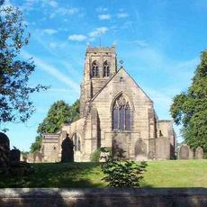
Church of St Mary the Virgin
2 km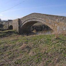
Bellasis Bridge
599 m
The Seed House, South West Of Blagdon Hall Stables, With Wall To East
2.3 km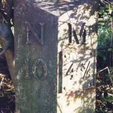
Milepost East Of Road 80 Metres South Of Swan Farmhouse
2.1 km
The Old Vicarage
2.1 km
Garden Walls To East And South Of The Old Vicarage
2.1 km
Young Headstone 2.5 Metres South Of Church Of St Mary
2 km
Vale House, With Attached Pier, Wall And Railings
2.2 km
Garden Walls, Attached Outbuildings, Greenhouse And Pillars, West Of Blagdon Hall
2 km
Drinking Fountain 90 Metres South East Of The Old Vicarage
2.2 km
Middle Duddo Farmhouse And Adjacent Outbuildings
1.8 km
The Iron Bridge 200 Metres North West Of Blagdon Hall
2.2 km
Duddo Hill Farmhouse
2.3 km
Barn And Gingang To North West Of Duddo Hill Farmhouse
2.3 km
Gillespy Headstone 3 Metres South Of Church Of St Mary
2 km
Outbuilding East Of Middle Duddo Farmhouse
1.8 km
Moor Tomb 5 Metres East Of South Aisle Of Church Of St Mary
2 km
West House Farmhouse
2.1 km
Pond With Surrounding Walls, Benches And Urns, 300 Metres West Of Blagdon Hall
2.1 km
Coates Tomb 11 Metres South West Of Church Of St Mary
2 km
Swam Farmhouse
2.1 km
Beech Cottage
2.3 km
Old Horton Grange
2.2 km
Lych Gate to Church of St Mary the Virgin
2.1 km
Hall Tomb 2 Metres East Of Church Of St Mary
2.1 km
Churchyard Cross 15 Metres North East Of Church Of St Mary
2.1 km
Stone Coffin And Font Bowl Against South Wall Of Church Of St Mary
2 km
Make Me Rich Cheese Farm
1.1 kmReviews
Visited this place? Tap the stars to rate it and share your experience / photos with the community! Try now! You can cancel it anytime.
Discover hidden gems everywhere you go!
From secret cafés to breathtaking viewpoints, skip the crowded tourist spots and find places that match your style. Our app makes it easy with voice search, smart filtering, route optimization, and insider tips from travelers worldwide. Download now for the complete mobile experience.

A unique approach to discovering new places❞
— Le Figaro
All the places worth exploring❞
— France Info
A tailor-made excursion in just a few clicks❞
— 20 Minutes