Tienbunders, protected area in Belgium (NBP-VB-18-0040 (type 2))
Location: Zoutleeuw
Inception: 2021
GPS coordinates: 50.87678,5.04886
Latest update: November 12, 2025 23:34
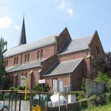
Onze-Lieve-Vrouw van de Rozenkranskerk
636 m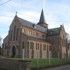
Onze-Lieve-Vrouw van het Heilig Hartkerk
3.6 km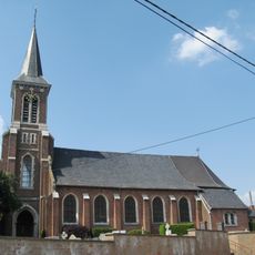
Sint-Germanuskerk
3.3 km
Tienbunders
407 m
Den Hoek
3.5 km
Kapel Heilig Hart
3.4 km
Kapel Onze Lieve Vrouw
1.7 km
Wayside shrine, Christianity, house of prayer, Catholic church building, place of worship
2.7 km
Catholic church building, wayside shrine, Christianity
3.6 km
Catholic church building, Christianity
3.3 km
Christianity, Catholic church building, wayside shrine
3.7 km
Onze-Lieve-Vrouwekapel
3 km
H Rochus
3.7 km
Christianity, Catholic church building, wayside shrine
2.8 km
O.L.Vr. van Rust
2.4 km
Catholic church building, wayside shrine, Christianity
1.8 km
Boomkapel
3.1 km
Boomkapel
1.2 km
Catholic church building, Christianity
1.5 km
Christianity, Catholic church building, wayside shrine
906 m
WO I
3.7 km
Houwitser 105mm
3.7 km
WO II
3.7 km
Mortier WOI
3.9 km
Oorlogsmonument WOI
3.9 km
Wayside shrine
1 km
Wayside shrine
1.3 km
Wayside shrine
2.3 kmReviews
Visited this place? Tap the stars to rate it and share your experience / photos with the community! Try now! You can cancel it anytime.
Discover hidden gems everywhere you go!
From secret cafés to breathtaking viewpoints, skip the crowded tourist spots and find places that match your style. Our app makes it easy with voice search, smart filtering, route optimization, and insider tips from travelers worldwide. Download now for the complete mobile experience.

A unique approach to discovering new places❞
— Le Figaro
All the places worth exploring❞
— France Info
A tailor-made excursion in just a few clicks❞
— 20 Minutes