Lac Île-à-la-Crosse Recreation Site, recreation site in Saskatchewan, Canada
Location: Northern Saskatchewan Administration District
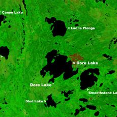
GPS coordinates: 55.35592,-107.86764
Latest update: November 24, 2025 02:49
Dore Lake
87.9 km
Smith Falls
66.5 km
Little Amyot Lake Recreation Site
19.8 km
Bazill Wildlife Refuge
74.3 km
Gatehouse Island Wildlife Refuge
39.6 km
Beatty Lake Recreation Site
93.4 km
Waterhen River Recreation Site
79.6 km
Canoe Lake Recreation Site
33.6 km
Smoothstone Lake Recreation Site
102.9 km
Gordon Lake Recreation Site
95.7 km
Dipper Rapids
71.5 km
Highway 155 Road Corridor Game Preserve
82.4 km
Bear Rapids
91.8 km
Pratt Rapids
99.9 km
Deer Rapids
80.1 km
Grand Rapids
60.1 km
Drum Rapids
73 km
Crooked Rapids
76.1 km
Shagwenaw Rapids
63.1 km
Dore Lake Recreation Site
83.6 km
Gale Rapids
99.9 km
Leaf Rapids
75.2 km
Knee Rapids
74.5 km
Snake Rapids
92.2 km
Smith Rapids
65.7 km
Taylor Lake Recreation Site
91.7 km
Rock Island Wildlife Refuge
83.4 km
Beaupré Creek Recreation Site
99.5 kmReviews
Visited this place? Tap the stars to rate it and share your experience / photos with the community! Try now! You can cancel it anytime.
Discover hidden gems everywhere you go!
From secret cafés to breathtaking viewpoints, skip the crowded tourist spots and find places that match your style. Our app makes it easy with voice search, smart filtering, route optimization, and insider tips from travelers worldwide. Download now for the complete mobile experience.

A unique approach to discovering new places❞
— Le Figaro
All the places worth exploring❞
— France Info
A tailor-made excursion in just a few clicks❞
— 20 Minutes