Kay Falls, waterfall in British Columbia, Canada
Location: British Columbia
GPS coordinates: 50.97194,-118.60833
Latest update: November 6, 2025 14:10

Yard Creek Provincial Park
16.4 km
Victor Lake Provincial Park
14.8 km
Anstey-Hunakwa Provincial Park
28.6 km
English Lake Provincial Park
20.3 km
Kingfisher Creek Provincial Park
22.2 km
Mount Griffin Provincial Park
5.5 km
St. Peter’s Anglican Church (Revelstoke)
28.7 km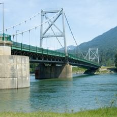
Revelstoke Bridge
27.5 km
Mount Griffin Ecological Reserve
9.5 km
Wap Creek Provincial Park
26.3 km
Kingfisher Creek Ecological Reserve
23.1 km
Steamboat Rapids
28.1 km
Frog Falls
12.5 km
The Salmon Rocks
27.5 km
Eagle River Provincial Park
7 km
The Last Spike Gift Shop
8.1 km
Revelstoke Golf Club
27 km
Гольф-Клуб
26.8 km
Columbia River Lookout
27.6 km
SkyTrek Adventure Park
2.9 km
The Enchanted Forest
3 km
Mt Begbie Trailhead
28.4 km
Woodenhead
27.6 km
Scenic viewpoint
26 km
Scenic viewpoint
300 m
View of crazy creek waterfall
3.7 km
Kay Falls
245 m
Frog Falls
12.5 kmReviews
Visited this place? Tap the stars to rate it and share your experience / photos with the community! Try now! You can cancel it anytime.
Discover hidden gems everywhere you go!
From secret cafés to breathtaking viewpoints, skip the crowded tourist spots and find places that match your style. Our app makes it easy with voice search, smart filtering, route optimization, and insider tips from travelers worldwide. Download now for the complete mobile experience.

A unique approach to discovering new places❞
— Le Figaro
All the places worth exploring❞
— France Info
A tailor-made excursion in just a few clicks❞
— 20 Minutes