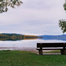
Drywilliam Lake Ecological Reserve, ecological reserve in British Columbia, Canada
Location: Regional District of Bulkley-Nechako
GPS coordinates: 54.06250,-124.70556
Latest update: November 22, 2025 02:23
Beaumont Provincial Park
5.8 km
Sowchea Bay Provincial Park
43.1 km
François Lake Provincial Park
32 km
Paarens Beach Provincial Park
45.2 km
Uncha Mountain Red Hills Provincial Park
55.1 km
Mount Pope Provincial Park
53.5 km
Nechako Canyon Protected Area
49.9 km
Sutherland River Provincial Park and Protected Area
51.7 km
Carrole Falls
57.2 km
Ellis Island Ecological Reserve
3.6 km
Sutherland River Provincial Park
51.7 km
Nechako River Migratory Bird Sanctuary
44.3 km
Francois Lake Protected Area
23.5 km
Paarens Beach
44.5 km
Cariboo Chilcotin Coast
54.9 km
Cheslatta Falls
48.9 km
Sandy Beach
48.5 km
Cottonwood Beach
51.6 km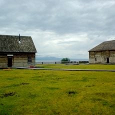
Fort St. James National Historic Site
51.2 km
Belisle Reservoir
13.3 km
Music Makers Hall
51.4 km
Paarens Beach
45.2 km
Work of art, sculpture
51.6 km
Work of art, sculpture
50.6 km
Scenic viewpoint
54 km
Scenic viewpoint
11.5 km
Scenic viewpoint, tower
45.4 km
Cheslatta Falls
48.8 kmReviews
Visited this place? Tap the stars to rate it and share your experience / photos with the community! Try now! You can cancel it anytime.
Discover hidden gems everywhere you go!
From secret cafés to breathtaking viewpoints, skip the crowded tourist spots and find places that match your style. Our app makes it easy with voice search, smart filtering, route optimization, and insider tips from travelers worldwide. Download now for the complete mobile experience.

A unique approach to discovering new places❞
— Le Figaro
All the places worth exploring❞
— France Info
A tailor-made excursion in just a few clicks❞
— 20 Minutes