
Diedenbergen, municipal district of Hofheim am Taunus, Germany
Location: Hofheim am Taunus
Elevation above the sea: 188 m
GPS coordinates: 50.06160,8.42000
Latest update: March 4, 2025 03:47


Evangelische Kirche Diedenbergen
43 m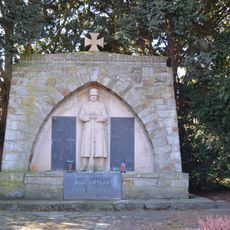
War memorial Marxheim
1.1 km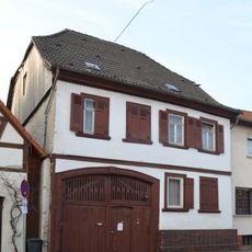
Casteller Straße 72
81 m
Schloßstraße 6
1.4 km
Ehemalige Schule/Rathaus
25 m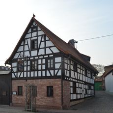
Casteller Straße 66
7 m
Grüne Straße 8
98 m
Eichstraße 5
1.3 km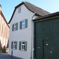
Eichstraße 14
1.3 km
Hintergasse 38
67 m
Pfarrgartenstraße 4
59 m
Pfarrgartenstraße 6
66 m
Pfarrgartenstraße 11
103 m
Ehemaliges Pfarrhaus
116 m
Schulstraße 62
1.4 km
Casteller Straße 49
129 m
Weilbacher Straße 5
87 m
Grüne Straße 30
205 m
Eichstraße 16
1.3 km
Casteller Straße 60
39 m
Friedhof Marxheim
1.2 km
Schulstraße 61
1.4 km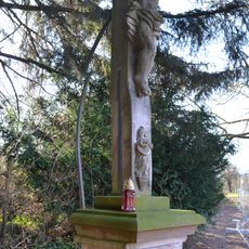
Wegkreuz
1.1 km
Pietà
1.3 km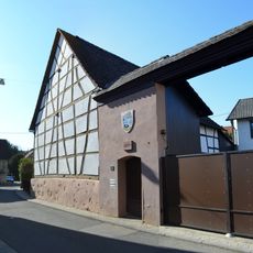
Ringstraße 2
1.4 km
Casteller Straße 31
99 m
Casteller Straße 39
51 m
Philipp-Keim-Straße 1
105 mReviews
Visited this place? Tap the stars to rate it and share your experience / photos with the community! Try now! You can cancel it anytime.
Discover hidden gems everywhere you go!
From secret cafés to breathtaking viewpoints, skip the crowded tourist spots and find places that match your style. Our app makes it easy with voice search, smart filtering, route optimization, and insider tips from travelers worldwide. Download now for the complete mobile experience.

A unique approach to discovering new places❞
— Le Figaro
All the places worth exploring❞
— France Info
A tailor-made excursion in just a few clicks❞
— 20 Minutes