
Grenzsäule, steinerne Säule mit würfelartigem Dachaufsatz, bezeichnet 1676 und 1893
Location: Vilsbiburg
Address: Flur Reit
GPS coordinates: 48.46084,12.35767
Latest update: November 22, 2025 14:47
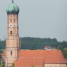
Stadtpfarrkirche Mariä Himmelfahrt
992 m
Feldkapelle
1.2 km
Friedhofsmauer Kirchstraße 13 in Vilsbiburg
1 km
Cultural heritage D-2-7540-0203 in Vilsbiburg
1 km
Arkadenhalle Kirchstraße 13 in Vilsbiburg
960 m
Friedhof Kirchstraße 13 in Vilsbiburg
946 m
Nebengebäude Obere Stadt 25 in Vilsbiburg
1.3 km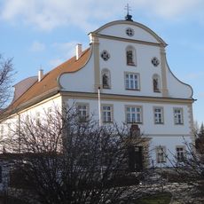
Pfarrhof
944 m
Kirchenweg 1
1.1 km
Oberes Tor
1.3 km
Obere Stadt 33
1.2 km
Obere Stadt 25
1.3 km
Cultural heritage D-2-7540-0201 in Vilsbiburg
1.3 km
Stadtplatz 1
1.3 km
Cultural heritage D-2-7540-0138 in Vilsbiburg
1.2 km
Cultural heritage D-2-7540-0104 in Vilsbiburg
521 m
Einfriedung Kirchstraße 15 in Vilsbiburg
951 m
Arkadenhalle Kirchstraße 13 in Vilsbiburg
985 m
Zugehörige Wasserpumpe mit Windrad
817 m
Friedhofsmauer Kirchstraße 13 in Vilsbiburg
938 m
Arkadenhalle Kirchstraße 13 in Vilsbiburg
920 m
Bayrischer Löwe
1.2 km
Wayside cross
1.2 km
Wayside cross
603 m
Wayside cross
1.2 km
Wayside cross
821 m
Wayside cross
411 m
Wayside cross
1.3 kmReviews
Visited this place? Tap the stars to rate it and share your experience / photos with the community! Try now! You can cancel it anytime.
Discover hidden gems everywhere you go!
From secret cafés to breathtaking viewpoints, skip the crowded tourist spots and find places that match your style. Our app makes it easy with voice search, smart filtering, route optimization, and insider tips from travelers worldwide. Download now for the complete mobile experience.

A unique approach to discovering new places❞
— Le Figaro
All the places worth exploring❞
— France Info
A tailor-made excursion in just a few clicks❞
— 20 Minutes