Stadel, zugehöriger Stadel, mit Traidkasten und Schrot, 18./19. Jahrhundert
Location: Haarbach
Address: Grub 1
GPS coordinates: 48.49316,13.16532
Latest update: November 17, 2025 21:39

Hofkapelle
957 m
Mittertennhaus
989 m
Kornspeicher St.-Andreas-Straße 5 in Haarbach
1.2 km
Hakenhof
1.3 km
Kornspeicher Riedertsham 2 in Haarbach
1.2 km
Stallstadel Hötzenham 11 in Haarbach
1.3 km
Cultural heritage D-2-7445-0025 in Haarbach
1.1 km
Flügel mit Hoftor und Traidkasten
324 m
Wohnhaus des Vierseithofes
1.3 km
Nebengebäude Unteruttlau 3 in Haarbach
1.1 km
Bauernhaus
1 km
Unteruttlau 13a
837 m
Bauernhaus
585 m
Bauernhaus
919 m
Cultural heritage D-2-7545-0028 in Haarbach
1.3 km
Traidkasten
452 m
Wohnhaus des Vierseithofes
1.3 km
Nebengebäude
1.3 km
Rottaler Bauernhaus
1.1 km
Wohnhaus des Vierseithofes
1.1 km
Ortskapelle
302 m
Cultural heritage D-2-7545-0026 in Haarbach
923 m
Oberuttlau St.-Andreas-Straße 5
1.2 km
Wohnhaus des Dreiseithofes
1.2 km
Cultural heritage D-2-7545-0019 in Haarbach
795 m
Kornspeicher Hötzenham 11 in Haarbach
1.2 km
Bauernhaus
563 m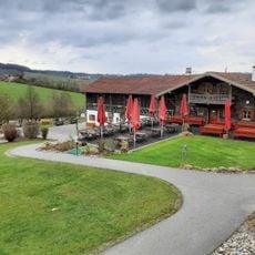
Golfplatz Brunnwies
239 mReviews
Visited this place? Tap the stars to rate it and share your experience / photos with the community! Try now! You can cancel it anytime.
Discover hidden gems everywhere you go!
From secret cafés to breathtaking viewpoints, skip the crowded tourist spots and find places that match your style. Our app makes it easy with voice search, smart filtering, route optimization, and insider tips from travelers worldwide. Download now for the complete mobile experience.

A unique approach to discovering new places❞
— Le Figaro
All the places worth exploring❞
— France Info
A tailor-made excursion in just a few clicks❞
— 20 Minutes