
Kelleranlage mit Tonnengewölbe
Kelleranlage mit Tonnengewölbe, vor 19. Jahrhundert; unter dem Nebengebäude der Brauerei
Location: Roding
Address: Falkensteiner Straße 7a
GPS coordinates: 49.19498,12.51783
Latest update: November 20, 2025 12:05
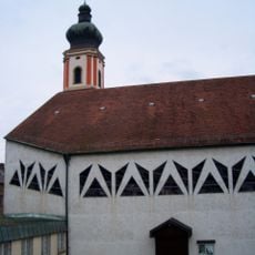
St. Pankratius
175 m
Annakapelle
169 m
Josephi- und Anna-Kapelle Roding
170 m
Rathaus Marktplatz 8 in Roding
178 m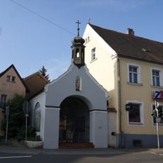
Sebastianikapelle
109 m
Gedenkstein Regensburger Straße 1 in Roding
108 m
Turm
165 m
Sogenannter Fellerturm, ehemaliger Wehrturm
177 m
Cultural heritage D-3-6841-0139 in Roding
152 m
Cultural heritage D-3-6841-0007 in Roding
176 m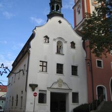
Rathaus
177 m
Ehemalige Fronfeste
152 m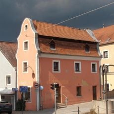
Roding Oberer Markt 2
117 m
Stadtmauer
180 m
Bürgerhaus
148 m
Gasthaus
148 m
Gasthaus
160 m
Wohnhaus
186 m
Pranger Marktplatz 8 in Roding
180 m
Kapelle Kirchplatz 2 in Roding
166 m
Cultural heritage D-3-6841-0140 in Roding
150 m
Wohnhaus
174 m
Altes Rathaus mit Pranger
176 m
Wehrmauer mit Turm
143 m
Brunnen
155 m
Pankratiussäule
131 m
Kriegerdenkmal
178 m
Pranger
181 mReviews
Visited this place? Tap the stars to rate it and share your experience / photos with the community! Try now! You can cancel it anytime.
Discover hidden gems everywhere you go!
From secret cafés to breathtaking viewpoints, skip the crowded tourist spots and find places that match your style. Our app makes it easy with voice search, smart filtering, route optimization, and insider tips from travelers worldwide. Download now for the complete mobile experience.

A unique approach to discovering new places❞
— Le Figaro
All the places worth exploring❞
— France Info
A tailor-made excursion in just a few clicks❞
— 20 Minutes