Stadel, mit reicher Gitterbundwerkzone über unverputztem Backstein, nach Mitte 19. Jahrhundert
Location: Hebertsfelden
Address: Schönhub 6
GPS coordinates: 48.38400,12.80171
Latest update: November 19, 2025 02:39
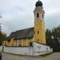
Pfarrkirche St. Georg
2.6 km
Querstockhaus eines Vierseithofes
1.5 km
Katholische Filialkirche St. Koloman
2.4 km
Hofkapelle
1.1 km
Cultural heritage D-2-7542-0002 in Eggenfelden
2.6 km
Cultural heritage D-2-7642-0004 in Hebertsfelden
1.9 km
Scheune Buchner 2 in EggenfeLenn
1.5 km
Cultural heritage D-2-7642-0005 in Hebertsfelden
1.6 km
Cultural heritage D-2-7643-0066 in Hebertsfelden
2.5 km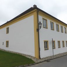
Ehemaliger Pfarrhof
2.4 km
Cultural heritage D-2-7642-0073 in Eggenfelden
2.6 km
Cultural heritage D-2-7642-0016 in Wurmannsquick
1.7 km
Kleinbauernhaus
1.4 km
Einzelhof
1.5 km
Wohnstallhaus eines Vierseithofes
2.3 km
Friedhofsmauer Hofmark 46 in EggenfeLenn
2.6 km
Wohnstallhaus mit teilverschaltem Blockbau-Obergeschoss
1.7 km
Kornspeicher Hinterloh 1 in Wurmannsquick
2.3 km
Querstockhaus eines Vierseithofes
1.1 km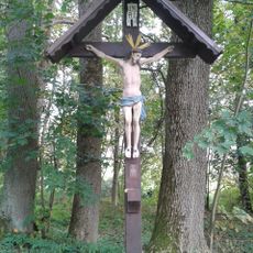
Feldkreuz
2.5 km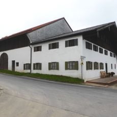
Bauernhaus
2.4 km
Cultural heritage D-2-7642-0015 in Wurmannsquick
1.7 km
Scheune Hinterloh 1 in Wurmannsquick
2.3 km
Wayside shrine, Christianity
2.2 km
Wayside cross
2.5 km
Wayside cross
1.9 km
Wayside cross
2.6 km
Wayside cross
861 mReviews
Visited this place? Tap the stars to rate it and share your experience / photos with the community! Try now! You can cancel it anytime.
Discover hidden gems everywhere you go!
From secret cafés to breathtaking viewpoints, skip the crowded tourist spots and find places that match your style. Our app makes it easy with voice search, smart filtering, route optimization, and insider tips from travelers worldwide. Download now for the complete mobile experience.

A unique approach to discovering new places❞
— Le Figaro
All the places worth exploring❞
— France Info
A tailor-made excursion in just a few clicks❞
— 20 Minutes