
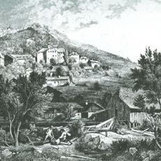
Ehemaliger Brauereigasthof
Ehemaliger Brauereigasthof, zweigeschossiger Walmdachbau mit Zwerchhaus und Putzgliederungen, 1870;
Location: Hohenwarth
Address: Lamer Straße 8; Gutshofweg
GPS coordinates: 49.20409,12.95145
Latest update: November 14, 2025 07:04
Schloss Hohenwarth
1.3 km
Burgstall Wachsteinfelsen
1.3 km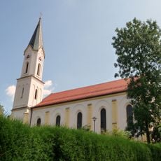
Sankt Johannes Baptist
1.2 km
Wegkapelle, sogenannte Hussitenkapelle
791 m
Waldkapelle
2.4 km
Wegkapelle
2.3 km
Cultural heritage D-3-6743-0077 in Hohenwarth (Landkreis Cham)
1.3 km
Brauerei Lamer Straße 8 in Hohenwarth (Landkreis Cham)
33 m
Kirche Kirchstraße 10 in Hohenwarth (Landkreis Cham)
1.3 km
Waldlerhaus
1.2 km
Ehemaliges Schloss
1.3 km
Cultural heritage D-3-6743-0075 in Hohenwarth (Landkreis Cham)
791 m
Grabmal Kirchstraße 10 in Hohenwarth (Landkreis Cham)
1.2 km
Cultural heritage D-3-6743-0078 in Hohenwarth (Landkreis Cham)
1.3 km
Waldlerhaus
1.3 km
Hofkapelle
1.1 km
Wohnhaus
135 m
Waldlerhaus, ehemaliger Wohnteil
621 m
Friedhofstor Kirchstraße 10 in Hohenwarth (Landkreis Cham)
1.2 km
Cultural heritage D-3-6743-0079 in Hohenwarth (Landkreis Cham)
1.3 km
Waldlerhaus
1.9 km
Pavillon Lamer Straße 8 in Hohenwarth (Landkreis Cham)
22 m
Burgstall
1.3 km
Wayside cross
2.1 km
Wayside shrine
2.2 km
Wayside cross
1.5 km
Wayside cross
1.4 km
Wayside cross
2.6 kmReviews
Visited this place? Tap the stars to rate it and share your experience / photos with the community! Try now! You can cancel it anytime.
Discover hidden gems everywhere you go!
From secret cafés to breathtaking viewpoints, skip the crowded tourist spots and find places that match your style. Our app makes it easy with voice search, smart filtering, route optimization, and insider tips from travelers worldwide. Download now for the complete mobile experience.

A unique approach to discovering new places❞
— Le Figaro
All the places worth exploring❞
— France Info
A tailor-made excursion in just a few clicks❞
— 20 Minutes