Sennebäche, protected area in the European Union defined by the habitats directive in Nordrhein-Westfalen, Germany
Location: Verl
Inception: 1999
GPS coordinates: 51.87320,8.60340
Latest update: November 23, 2025 22:04
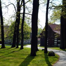
Hof Johannliemke
1.6 km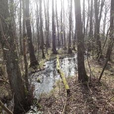
Rixelbruch
2.3 km
Holter Wald
2.1 km
Catholic church building, wayside shrine, Christianity
1.7 km
Wayside shrine, Christianity
913 m
Heiligenhäuschen
2.5 km
Wayside shrine
1.6 km
Wayside shrine
1.2 km
Wayside shrine, Christianity, Catholic church building
2.2 km
Christianity, Catholic church building, wayside shrine
2.4 km
Catholic church building, wayside shrine, Christianity
1.7 km
Christianity, Catholic church building, wayside shrine
1.2 km
Wayside cross, Christianity, Catholic church building
2 km
Christianity, Catholic church building, wayside shrine
1.1 km
Scenic viewpoint
651 m
Catholic church building, wayside shrine, Christianity
1.6 km
Denkmal Holzkreuz
2.4 km
Christianity, Catholic church building, wayside shrine
1.9 km
Wayside shrine, Christianity, Catholic church building
1.6 km
Catholic church building, wayside shrine, Christianity
776 m
Catholic church building, wayside shrine, Christianity
1.7 km
Wayside shrine, Christianity, Catholic church building
1.2 km
Wayside shrine
264 m
Wayside shrine
646 m
Wayside shrine
1.2 km
Wayside shrine
876 m
Wayside shrine
663 m
Wayside shrine
729 mReviews
Visited this place? Tap the stars to rate it and share your experience / photos with the community! Try now! You can cancel it anytime.
Discover hidden gems everywhere you go!
From secret cafés to breathtaking viewpoints, skip the crowded tourist spots and find places that match your style. Our app makes it easy with voice search, smart filtering, route optimization, and insider tips from travelers worldwide. Download now for the complete mobile experience.

A unique approach to discovering new places❞
— Le Figaro
All the places worth exploring❞
— France Info
A tailor-made excursion in just a few clicks❞
— 20 Minutes