
Wohnstallhaus eines Vierseithofes, building in Neualbenreuth, Upper Palatinate, Germany
Location: Bad Neualbenreuth
Address: Tirschenreuther Straße 19
GPS coordinates: 49.97372,12.45112
Latest update: November 21, 2025 06:36
Ensemble
891 m
Friedhofskapelle Nähe Marktplatz in Bad Neualbenreuth
899 m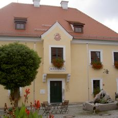
Ehemaliges Egerer Amtshaus, 1830–1910 Schule, seit 1911 Rathaus
869 m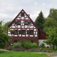
Försterhaus, sogenanntes Egerer Forsthaus
649 m
Stallgebäude und ehemaliges Gesindehaus
638 m
Ehemaliges Wohnstallhaus
847 m
Wohnstallhaus
883 m
Scheune Platzermühle 3 in Bad Neualbenreuth
641 m
Scheune Tirschenreuther Straße 19 in Bad Neualbenreuth
22 m
Wohnhaus eines Vierseithofes
898 m
Wohn- und ehemaliges Gasthaus
716 m
Wohnstallhaus
838 m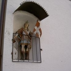
Hausfigur des heiligen Florian
870 m
Stadel
645 m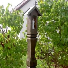
Hölzerner Säulenbildstock
889 m
Ehemaliges Wohnstallhaus eines Vierseithofes
732 m
Scheune
718 m
Austragshaus Raiffeisenstraße 14 in Bad Neualbenreuth
722 m
Ehemaliger Schupfen
693 m
Ehemaliges Handwerkerhaus
724 m
Ehemaliges Handwerkerhaus
726 m
Wohnhaus
794 m
Wohnhaus
880 m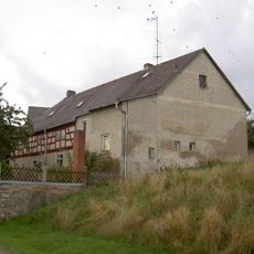
Ehemaliger Wohnteil eines Bauernhauses, seit 1886 Gasthaus
874 m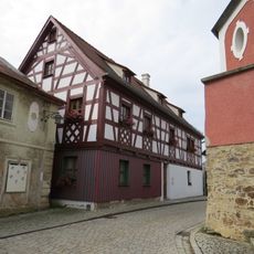
Ehemaliges Gasthaus
888 m
Gradlhof
345 m
Schuppen Hirtgasse 5 in Bad Neualbenreuth
843 m
Wayside cross, Christianity
541 mReviews
Visited this place? Tap the stars to rate it and share your experience / photos with the community! Try now! You can cancel it anytime.
Discover hidden gems everywhere you go!
From secret cafés to breathtaking viewpoints, skip the crowded tourist spots and find places that match your style. Our app makes it easy with voice search, smart filtering, route optimization, and insider tips from travelers worldwide. Download now for the complete mobile experience.

A unique approach to discovering new places❞
— Le Figaro
All the places worth exploring❞
— France Info
A tailor-made excursion in just a few clicks❞
— 20 Minutes