Angasilla Hill, hill in Estonia
Location: Märjamaa Rural Municipality
Elevation above the sea: 40 m
GPS coordinates: 58.92694,24.27529
Latest update: November 19, 2025 20:31
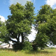
Sipa lime tree
932 m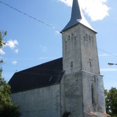
Märjamaa Church
9.2 km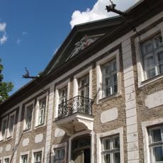
Maidla manor
8.5 km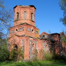
Märjamaa Orthodox Church
8.8 km
Mustallikas
8.5 km
Sõtke linnus
7.1 km
Koluvere manor park
10 km
Iganõmme Nature Park
5.2 km
Märjamaa kalmistu
9.5 km
Laukna ohvrikivi
7 km
Sipa sild
1.6 km
Neitsipere Springs
9.7 km
Laukna hiiekivi
6 km
Kantsimäe linnusease
7.5 km
Vinguta küla paemurd
2.9 km
Sõtke loopealne
6.6 km
Vaikna mõisa kivisild
9.4 km
Kurisu-Jaani Spring
6.5 km
Üüste Springs
8.5 km
Sõtke hobukastanid
7 km
Sipa manor house
2 km
Märjamaa (kivi)loomaaed
9.1 km
Ly Galerii
9.1 km
Luiste Küla
9.5 km
Mälestuskivi
9.3 km
Memorial, commemorative plaque
8.6 km
Memorial stone, memorial
8.6 km
Memorial stone, memorial
9.5 kmReviews
Visited this place? Tap the stars to rate it and share your experience / photos with the community! Try now! You can cancel it anytime.
Discover hidden gems everywhere you go!
From secret cafés to breathtaking viewpoints, skip the crowded tourist spots and find places that match your style. Our app makes it easy with voice search, smart filtering, route optimization, and insider tips from travelers worldwide. Download now for the complete mobile experience.

A unique approach to discovering new places❞
— Le Figaro
All the places worth exploring❞
— France Info
A tailor-made excursion in just a few clicks❞
— 20 Minutes