Punta de l'Edrera, mountain in Spain
Location: Alfara
Elevation above the sea: 1,080.2 m
GPS coordinates: 40.86211,0.34706
Latest update: November 21, 2025 12:05
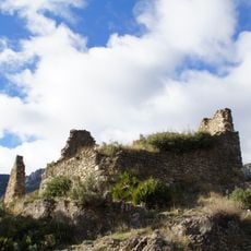
Castell de Carles
1.7 km
Tosseta Rasa
2.5 km
Sant Julià
1.5 km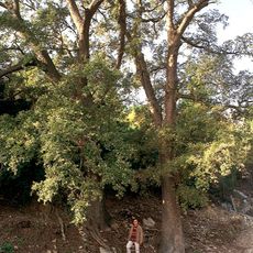
Roures dels Ullals
1.6 km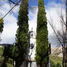
Santa Magdalena del Toscar
2 km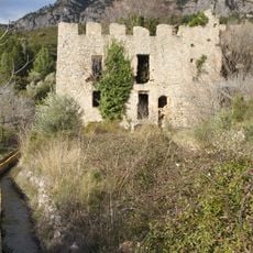
Fàbrica Pallarés
1.9 km
Cap de la Faixa Blanca
3 km
Santa Llúcia del Toscar
2 km
Punta de la Serena
2 km
Punta de la Miranda
2 km
Punta del Bassiol
2.2 km
Punta de la Creueta
2.5 km
Punta de Marranya
340 m
Prop de la Cova Pintada
2.3 km
L'Espina
2.4 km
Coll Triador
2.2 km
Viewpoints of Roques de Benet, Els Ports
2.7 km
Scenic viewpoint
2.7 km
Scenic viewpoint
2.2 km
Mas del Marraco
1.7 km
Ruins
1.6 km
Mas del Patut
3 km
Mas d'Atans
3 km
Forn de calç
2 km
La fàbrica de Pallarès
2 km
Erms de Beco
2.9 km
Forn de calç
1.9 km
Forn de calç
1.9 kmReviews
Visited this place? Tap the stars to rate it and share your experience / photos with the community! Try now! You can cancel it anytime.
Discover hidden gems everywhere you go!
From secret cafés to breathtaking viewpoints, skip the crowded tourist spots and find places that match your style. Our app makes it easy with voice search, smart filtering, route optimization, and insider tips from travelers worldwide. Download now for the complete mobile experience.

A unique approach to discovering new places❞
— Le Figaro
All the places worth exploring❞
— France Info
A tailor-made excursion in just a few clicks❞
— 20 Minutes