
Romano-British farmstead, 1.3km north east of Harwood Head
Romano-British farmstead, 1.3km north east of Harwood Head, archaeological site in Hollinghill, Northumberland, England, UK
Catcherside Cottage
3.4 km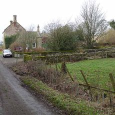
Hartington Hall
4.8 km
Limekilns Circa 300 Yards North Of High Hartington
4.5 km
Milestone Circa 400 Yards North West Of Ottercops Road End
3.8 km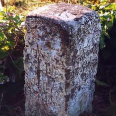
Milestone C 1/4 Mile North Of Knowesgate
5 km
Romano-British farmstead, 500m north of Herpath House
5 km
Steng Cross
2.2 km
Farmbuildings Circa 40 Yards North Of Greenleighton Farmhouse
4.4 km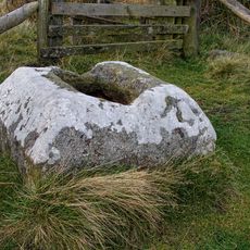
Winter's Gibbet and adjacent crossbase of Steng Cross
2.3 km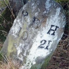
Milestone At Rothley Crossyards
3.7 km
Bastle 80m north east of Fallowlees
4.9 km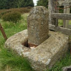
Manside defended settlement and medieval cross
1.1 km
Bastle House Circa 50 Yards North Of Whitlees
3 km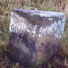
Milestone Circa 1000 Yards South Of Blaxter Cottages
4.4 km
Cup and ring marked rock on Tod Crag
2.2 km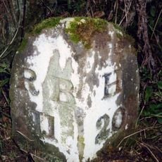
Milestone Circa A Quarter Of A Mile South Of Hartington Road End
4.9 km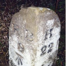
Milestone At Donkin Rigg Road End
4.9 km
Ant Hills (burial mounds), Monkridge
2.2 km
Birky Burn settlement
1.4 km
Catcherside Camp
3.7 km
Gallows Hill Farmhouse
4 km
Field Wall Circa 10 Yards South Of Hartington Hall
4.8 km
Pigsty And Henhouse Circa 20 Yards North East Of Gallows Hill Farmhouse
4 km
Romano-British farmstead, 650m ENE of Wolf Crag
2.4 km
Farmbuildings Circa 10 Yards West Of Gallows Hill Farmhouse
4 km
Fairnley Farmhouse
2.9 km
Bastle Houses At Ottercops Farm
3.4 km
Romano-British farmstead 470m north of Coldwell
4 kmReviews
Visited this place? Tap the stars to rate it and share your experience / photos with the community! Try now! You can cancel it anytime.
Discover hidden gems everywhere you go!
From secret cafés to breathtaking viewpoints, skip the crowded tourist spots and find places that match your style. Our app makes it easy with voice search, smart filtering, route optimization, and insider tips from travelers worldwide. Download now for the complete mobile experience.

A unique approach to discovering new places❞
— Le Figaro
All the places worth exploring❞
— France Info
A tailor-made excursion in just a few clicks❞
— 20 Minutes