
Two medieval fishponds 170m north of Little Park Farm
Two medieval fishponds 170m north of Little Park Farm, archaeological site in Royal Wootton Bassett, Wiltshire, England, UK
Location: Royal Wootton Bassett
GPS coordinates: 51.52330,-1.92307
Latest update: November 15, 2025 17:01
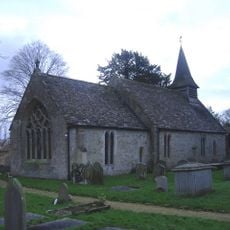
Church of St Giles
1.8 km
Jacob Pinneger Monument In The Churchyard Immediately South Of West Bay Of Chancel, Church Of St Giles
1.8 km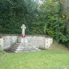
Tockenham War Memorial
1.7 km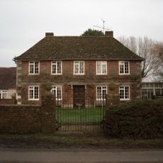
Greenway Farmhouse
1.7 km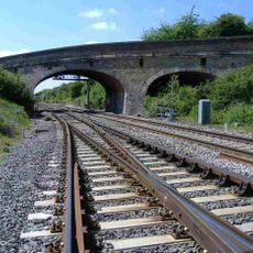
Hunts Mill Road Bridge
1.6 km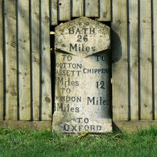
Milestone At Ngr Su 043810
1.2 km
Lower Greenhill Farm
707 m
23, Primrose Hill
1.6 km
Romano-British villa complex 330m north west of Queen Court Farm
1.7 km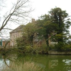
Queen's Court Farmhouse
1.7 km
4 And 5
2 km
Gate Piers At Entrance To Manor House
2 km
Vastern House
1.1 km
Shaw Farmhouse
2 km
Christopher Pinneger Monument In The Churchyard Immediately South Of West Bay Of Chancel
1.9 km
Stables At Manor House
2 km
Barton Cottage
2 km
Headstone, In The Churchyard 5 Metres East Of East Wall Of Chancel, Church Of St Giles
1.8 km
Little Park Farm
156 m
Brindley Cottage
1.1 km
Gazebo In Grounds Of Manor House, South West Of Main Block
2 km
Barn On Roadside, South West Of Manor House
2 km
Wall Between Barn And Front Garden Wall Gatepiers
2 km
Hunt Mill Farm
1.1 km
Manor House
2 km
3 Tockenham Wick
2 km
Dovecote And Stable Immediately North Of Manor House
2 km
Wiltshire Golf and Country Club
563 mReviews
Visited this place? Tap the stars to rate it and share your experience / photos with the community! Try now! You can cancel it anytime.
Discover hidden gems everywhere you go!
From secret cafés to breathtaking viewpoints, skip the crowded tourist spots and find places that match your style. Our app makes it easy with voice search, smart filtering, route optimization, and insider tips from travelers worldwide. Download now for the complete mobile experience.

A unique approach to discovering new places❞
— Le Figaro
All the places worth exploring❞
— France Info
A tailor-made excursion in just a few clicks❞
— 20 Minutes