Indrefjordtind, Berggipfel in Norwegen
Location: Hammerfest Municipality
Elevation above the sea: 400 m
GPS coordinates: 70.61689,23.73908
Latest update: November 15, 2025 17:30


Royal and Ancient Polar Bear Society
5.8 km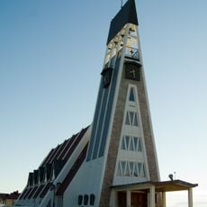
Hammerfest Church
5.5 km
Museum of Reconstruction
5.5 km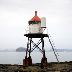
Fuglenes Lighthouse
6.3 km
Akkarfjorden
4 km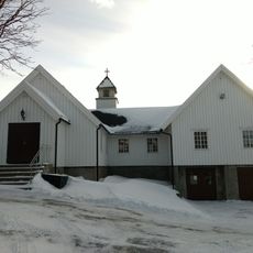
Indrefjord kapell
2.9 km
Klinkastupet
5.1 km
Guoccanjárga/Grøtnes
6 km
Gieldaluokta/Skjåholmbukta
6.4 km
Mollstranddalen
2.2 km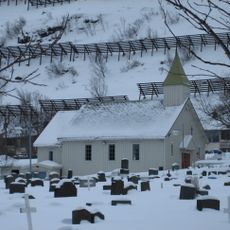
Haugen/Hammerfest andre kirkegård
5.4 km
Fuglenes
6.5 km
Rypefjord
3 km
Langvatnet
4.1 km
Indrefjorddalen
1.5 km
Hammerfest første bykirkegård
5.6 km
Mollstrandalen
2.2 km
Mollstrand
2.4 km
Mollstrand
2.1 km
Kirkegårdsøya
3.8 km
Veararášša
1.4 km
Mulig seterlokalitet Storvannet
4.2 km
Seterlokalitet Svartvannet
5.1 km
The Boathouse
6.4 km
Mor og barn
5.5 km
Work of art, statue
5.5 km
Work of art, sculpture
5.5 km
Scenic viewpoint
5.3 kmReviews
Visited this place? Tap the stars to rate it and share your experience / photos with the community! Try now! You can cancel it anytime.
Discover hidden gems everywhere you go!
From secret cafés to breathtaking viewpoints, skip the crowded tourist spots and find places that match your style. Our app makes it easy with voice search, smart filtering, route optimization, and insider tips from travelers worldwide. Download now for the complete mobile experience.

A unique approach to discovering new places❞
— Le Figaro
All the places worth exploring❞
— France Info
A tailor-made excursion in just a few clicks❞
— 20 Minutes