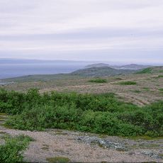
Dákkosáttu, beach in Nesseby, Finnmark, Norway
Location: Nesseby Municipality
GPS coordinates: 70.05000,29.10505
Latest update: November 10, 2025 20:56
Varangerfjord
5.9 km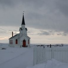
Nesseby Church
14.1 km
Mortensnes
8.9 km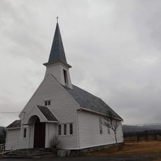
Vestre Jakobselv Church
11.1 km
Brannsletta
7.3 km
Nuortalašgavva
13.4 km
1.Fossen
12.2 km
Maŋŋegeahče
8.6 km
Čoalbmeriddu
7 km
Giettáid
8.4 km
Pierasáttu
3.2 km
Álddagárggu
4.1 km
Stuorračievra
12.4 km
Andrefossen
12.4 km
Rávttegáissát
2.3 km
Ramntinden (tumoy sa bukid sa Noruwega, Finnmark Fylke, Nesseby)
12.6 km
Trolldøren
8.6 km
Bielasluovttgohppi
3.2 km
Dároskálvi
11.1 km
Nesseby kirkested
14.1 km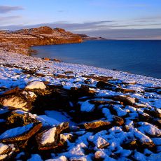
MORTENSNES
8.6 km
Umatrikulert statsgrunn
8.7 km
REISÆNENGÅRDEN
10.8 km
Varanger golfpark
12.1 km
Driving Range
12.3 km
Varanger golfpark
12 km
Andrefossen
12.4 km
Førstefossen
12.2 kmReviews
Visited this place? Tap the stars to rate it and share your experience / photos with the community! Try now! You can cancel it anytime.
Discover hidden gems everywhere you go!
From secret cafés to breathtaking viewpoints, skip the crowded tourist spots and find places that match your style. Our app makes it easy with voice search, smart filtering, route optimization, and insider tips from travelers worldwide. Download now for the complete mobile experience.

A unique approach to discovering new places❞
— Le Figaro
All the places worth exploring❞
— France Info
A tailor-made excursion in just a few clicks❞
— 20 Minutes