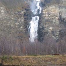
Nakabohalos, rapids in Nordreisa, Troms, Norway
Location: Nordreisa Municipality
GPS coordinates: 69.46178,21.52917
Latest update: June 13, 2024 15:10
Mollisfossen
16.3 km
Ráisduottarháldi
15.1 km
Puntankurkkii
5.5 km
Sarafossen
1.2 km
Cap'pesčåk'ka
16.1 km
Pihkahistamaelva
13.5 km
Gearpmesorda
6.1 km
Käyräniva
6.4 km
Mollešgorŋi
16.3 km
Jávreoaivvit
14.8 km
Puntafossen
5.5 km
Stuorra Njuorjujávri
15.8 km
Gahperus
10.1 km
Gahperus
10.5 km
Jávreoaivvit
14.4 km
Merkestein
15.6 km
Vuoððojávrit
13.3 km
Njuorjuvárri
16.3 km
Gahperus
10.5 km
Gellojävriberget
2.8 km
Vuoððojávrit
15.6 km
Stuorra Njuorjujávri
15.5 km
Gahperus
10.8 km
Puntafossen - Puntankurkkii
5.5 km
Scenic viewpoint
1.6 km
Sarafossen
1.3 km
Mollisfossen
16.3 km
Sarafossen - Čáragorži - Saarakurkkii
1.2 kmReviews
Visited this place? Tap the stars to rate it and share your experience / photos with the community! Try now! You can cancel it anytime.
Discover hidden gems everywhere you go!
From secret cafés to breathtaking viewpoints, skip the crowded tourist spots and find places that match your style. Our app makes it easy with voice search, smart filtering, route optimization, and insider tips from travelers worldwide. Download now for the complete mobile experience.

A unique approach to discovering new places❞
— Le Figaro
All the places worth exploring❞
— France Info
A tailor-made excursion in just a few clicks❞
— 20 Minutes