Sagbekkskåra, protected area in Norway
Location: Engerdal Municipality
GPS coordinates: 61.76600,11.92800
Latest update: November 9, 2025 23:15

Kvisleflået og Hovdlia
10.8 km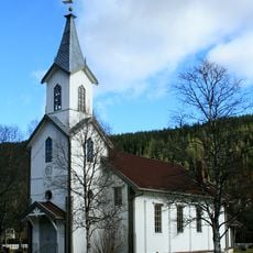
Engerdal Church
2 km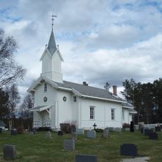
Drevsjø Church
14.3 km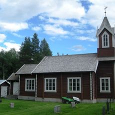
Søre Elvdal Church
13.2 km
Lomviksgården
17.1 km
Galtsjøen
17.3 km
Gammelkvernhusfossen
5.8 km
Viksæterfossen
13.1 km
Kvannhullfossen
14.7 km
Lekjenndalen
13.1 km
Luvhøa
8.1 km
Galtåsknappen
13.9 km
Elvsæterfossen
14.8 km
Elvbrufossen
15.8 km
Fløtfossen
15.2 km
Kvitvordaknappen
2.9 km
Blokkodden villmarksmuseum
14.1 km
Storhøa
7.6 km
Ånesteinen
13.6 km
Nordre Kvitvolaknappen
4.3 km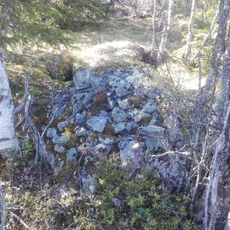
Tradisjonslokalitet
16.4 km
Hundskampen
3.4 km
Svarthammaren
5.8 km
Elvbrufossen
15.8 km
Gammelkvernhusfossen
5.8 km
Viksæterfossen
13.1 km
Elvsæterfossen
14.9 km
Fløtfossen
15.2 kmReviews
Visited this place? Tap the stars to rate it and share your experience / photos with the community! Try now! You can cancel it anytime.
Discover hidden gems everywhere you go!
From secret cafés to breathtaking viewpoints, skip the crowded tourist spots and find places that match your style. Our app makes it easy with voice search, smart filtering, route optimization, and insider tips from travelers worldwide. Download now for the complete mobile experience.

A unique approach to discovering new places❞
— Le Figaro
All the places worth exploring❞
— France Info
A tailor-made excursion in just a few clicks❞
— 20 Minutes