
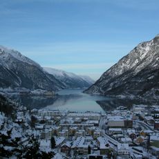
Fitjasete/Svarthammer
Location: Ullensvang Municipality
GPS coordinates: 60.19754,6.63049
Latest update: November 15, 2025 17:59
Sørfjorden
5 km
Vendevatnet
5 km
Elvanuten
2.3 km
Lausenut
2.9 km
Bjørnsnut
821 m
Gluggenuten
4.8 km
Gamlestovo på segelgjerd hovland
3.5 km
Skanuten
4.6 km
Elvanut
2.2 km
Lauvskardnuten
5 km
Klyvsnut
2.5 km
Dustutyver
1.6 km
Nipo
4.2 km
Stølsnuten
3.5 km
Nautaskardnuten
2.4 km
Meland - Fetts fk. 5, Våga (Meland I)
1 km
Hovland - Fetts fk. 4/1-4 (Hovland I - IV)
3.2 km
Hovland - Fetts NB (Hovland V)
4 km
Meland - Gropstein, Våga (Meland II)
999 m
Munnfus
3.7 km
Skjeldås - Fetts fk. 3
4.5 km
Fitjasete
360 m
Våga
980 m
Espe - Fetts fk. 3, Fitjasete (Bratt-Espe I)
275 m
Skjeldås - Fetts fk. 1/1-2, Munfushola
3.7 km
Hovland - Hovland VI (Hovlandstølen)
3.2 km
Skjeldås - Fetts fk. 5, Skjenafjell
3.8 km
Skjeldås - Fetts fk. 4, Gurohaug
3.8 kmReviews
Visited this place? Tap the stars to rate it and share your experience / photos with the community! Try now! You can cancel it anytime.
Discover hidden gems everywhere you go!
From secret cafés to breathtaking viewpoints, skip the crowded tourist spots and find places that match your style. Our app makes it easy with voice search, smart filtering, route optimization, and insider tips from travelers worldwide. Download now for the complete mobile experience.

A unique approach to discovering new places❞
— Le Figaro
All the places worth exploring❞
— France Info
A tailor-made excursion in just a few clicks❞
— 20 Minutes