Kraftverk, محطة طاقة في النرويج
Location: Etnedal Municipality
GPS coordinates: 60.87010,9.70700
Latest update: November 13, 2025 04:15
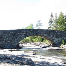
Lunde bridge
521 m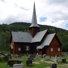
Bruflat Church
4.2 km
Føssatn
4.6 km
Utsikte
1.5 km
Klovoberget
1.3 km
Øspelundsveberget
1.3 km
Høgeføss
4.7 km
Lundebruføssen
572 m
Øygardsberget
1.8 km
Fossen
3.8 km
Lybekkberget
1 km
Rustbakkberget
2.3 km
Fløgeisberget
2.4 km
Skålerudberget
3.2 km
Plassaberget
5.2 km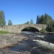
Lunde bru
523 m
Mølle, Møllersveføssen
3.3 km
Sag, Sørum
2.2 km
Breien kraftverk
5.4 km
Løypestreng, Hansespranget
1.5 km
Kvernveit
2.7 km
Løypestreng
1.1 km
Løypestreng, Andøye
341 m
Kraftverk, Bruflat
4 km
Sagbruk, Lunde og Follum fabrikker
633 m
Etnedal Sag og Høvleri
4.7 km
Mølle
630 m
Etna/Stamparstugu Mølle
2.6 kmReviews
Visited this place? Tap the stars to rate it and share your experience / photos with the community! Try now! You can cancel it anytime.
Discover hidden gems everywhere you go!
From secret cafés to breathtaking viewpoints, skip the crowded tourist spots and find places that match your style. Our app makes it easy with voice search, smart filtering, route optimization, and insider tips from travelers worldwide. Download now for the complete mobile experience.

A unique approach to discovering new places❞
— Le Figaro
All the places worth exploring❞
— France Info
A tailor-made excursion in just a few clicks❞
— 20 Minutes