Stangnes
Location: Senja Municipality
GPS coordinates: 69.01271,17.13175
Latest update: November 8, 2025 22:10

Skrolsvik fort
14.6 km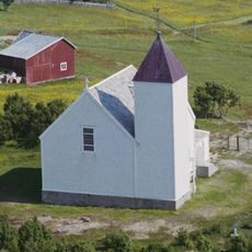
Andørja Church
9.9 km
Sandsøy fort
16.8 km
Stonglandet Church
8 km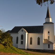
Dyrøy Church
14.7 km
Skrolsvik Chapel
13.9 km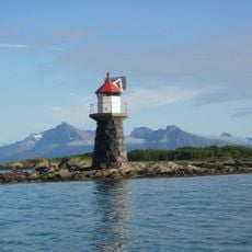
Stonglandseidet lighthouse
8.5 km
Stongodden
2.9 km
Lemmingvær
9.7 km
Heimstesanden
3.4 km
Lekangsøya
4.8 km
Sørstesanden
3.5 km
Fossen
12.3 km
Sjursvik
16.4 km
Stortind (tumoy sa bukid sa Noruwega, Troms Fylke, Tranøy)
12.1 km
Grinda
17.6 km
Leirpollen-Halsvatnet
5.8 km
Skrolsvik
13.8 km
Kalveberget
9.7 km
Klåpen
11.8 km
Hamn
12.1 km
Kastnesåsen og Grønlikollen naturreservat
16.9 km
Holm
14.7 km
Scenic viewpoint
5.3 km
Fossen
12.3 km
Cannon, bunker
14.6 km
Cannon, bunker
14.6 km
Cannon, bunker
14.7 kmReviews
Visited this place? Tap the stars to rate it and share your experience / photos with the community! Try now! You can cancel it anytime.
Discover hidden gems everywhere you go!
From secret cafés to breathtaking viewpoints, skip the crowded tourist spots and find places that match your style. Our app makes it easy with voice search, smart filtering, route optimization, and insider tips from travelers worldwide. Download now for the complete mobile experience.

A unique approach to discovering new places❞
— Le Figaro
All the places worth exploring❞
— France Info
A tailor-made excursion in just a few clicks❞
— 20 Minutes