
Układ urbanistyczny Baranowa
Location: Baranów, Greater Poland Voivodeship
Inception: 13 century
GPS coordinates: 51.26722,18.00278
Latest update: December 10, 2025 02:45
Synagogue in Kępno
1.7 km
Saint Martin church in Kępno
1.8 km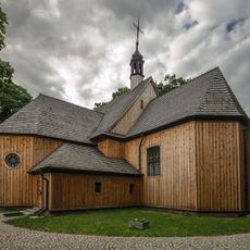
Saint Lawrence and Saint Andrew church
105 m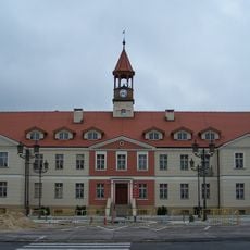
Kępno town hall
1.7 km
Muzeum Ziemi Kępińskiej
1.4 km
Park przy willi starosty
1.9 km
Gimnazjum, ob. LO
1.5 km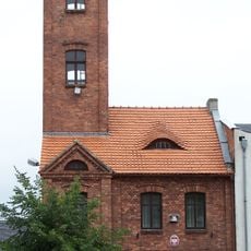
Fire station in Kępno
1.8 km
7 Kręta Street in Kępno
1.5 km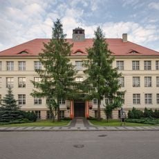
21 Sienkiewicza Street in Kepno
1.5 km
Magistrat, ob. biblioteka
1.7 km
Rynek 35
1.8 km
Budynek starostwa
2 km
20 Wawrzyniaka Street in Kępno
1.7 km
Budynek starostwa
1.9 km
Brama I
1.7 km
6 Szkolna Street in Kępno
1.8 km
Dom, XVIII/XIX
1.7 km
Dom, XVIII/XIX
1.8 km
Willa starosty
1.9 km
Zespół gimnazjum, ob. LO
1.5 km
Zespół starostwa
1.9 km
Rynek 36
1.8 km
Ogrodzenie z bramą
1.5 km
Kamienica z oficyną
1.8 km
Brama II
1.7 km
Zespół magistratu, ob. biblioteki
1.7 km
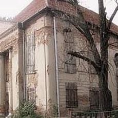
Dawna synagoga
1.7 kmVisited this place? Tap the stars to rate it and share your experience / photos with the community! Try now! You can cancel it anytime.
Discover hidden gems everywhere you go!
From secret cafés to breathtaking viewpoints, skip the crowded tourist spots and find places that match your style. Our app makes it easy with voice search, smart filtering, route optimization, and insider tips from travelers worldwide. Download now for the complete mobile experience.

A unique approach to discovering new places❞
— Le Figaro
All the places worth exploring❞
— France Info
A tailor-made excursion in just a few clicks❞
— 20 Minutes