
Molla, district in Herrljunga Municipality, Sweden
Location: Herrljunga Municipality
Inception: January 1, 2016
Part of: Västergötland
GPS coordinates: 57.93000,13.04111
Latest update: November 21, 2025 21:35
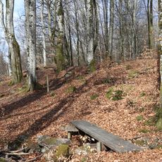
Molla bokskog
1.7 km
Domkullen
5.9 km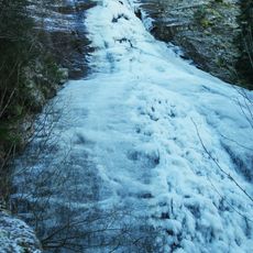
Fluxfallet
3.4 km
Molla 107:2
3.4 km
Hov 138:1
5 km
Molla 31:1
1.8 km
Molla 29:3
1.6 km
Molla 6:2
1.1 km
Molla 11:1
1.3 km
Molla 72:5
4.3 km
Vesene 8:1
2.5 km
Molla 38:1
5 km
Molla 42:2
4.9 km
Molla 46:1
2.7 km
Molla 20:1
1.9 km
Vesene 1:2
2.5 km
Domkullen
5.9 km
Molla 13:2
1.4 km
Molla 28:2
1.6 km
Vesene 9:1
2.8 km
Vesene 9:3
2.8 km
Vesene 10:1
5.3 km
Molla 92:1
5.3 km
Molla 93:1
5 km
Molla 107:1
3.4 km
Molla 9:1
1.4 km
Molla 6:4
1.1 km
Molla 6:3
1.1 kmReviews
Visited this place? Tap the stars to rate it and share your experience / photos with the community! Try now! You can cancel it anytime.
Discover hidden gems everywhere you go!
From secret cafés to breathtaking viewpoints, skip the crowded tourist spots and find places that match your style. Our app makes it easy with voice search, smart filtering, route optimization, and insider tips from travelers worldwide. Download now for the complete mobile experience.

A unique approach to discovering new places❞
— Le Figaro
All the places worth exploring❞
— France Info
A tailor-made excursion in just a few clicks❞
— 20 Minutes