
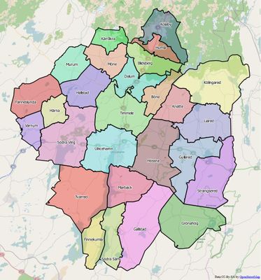
Timmele, district in Ulricehamn Municipality, Sweden
Location: Ulricehamn Municipality
Inception: January 1, 2016
Part of: Västergötland
GPS coordinates: 57.85278,13.43611
Latest update: November 21, 2025 10:34
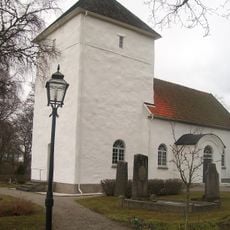
Dalums kyrka
5.8 km
Gräberfeld von Ek
2.6 km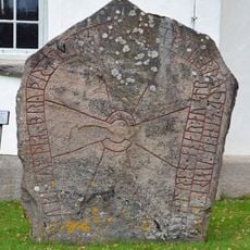
Västergötlands runinskrifter 197
5.8 km
Slottet vid Vist
4 km
Kycklingkullen
4.8 km
Västergötlands runinskrifter 173
5.7 km
Timmele 74:1
4.5 km
Fredsstenen
1.4 km
Fredsstenen
1.4 km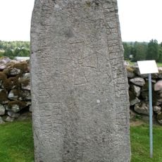
Vg 187
4.5 km
Dalum 49:5
5.1 km
Dalum 29:4
5.5 km
Hällstad 90:2
6.3 km
Timmele 9:2
4 km
Dalum 4:1
7.3 km
Ulricehamn 106:1
2.5 km
Dalum 49:4
5.1 km
Timmele 134:1
2.5 km
Dalum 53:1
4.5 km
Dalum 66:1
5.6 km
Dalum 87:1
3.9 km
Timmele 29:1
774 m
Fredsstenen
1.4 km
Timmele 18:2
3.5 km
Timmele 10:1
2.9 km
Timmele 56:1
2.5 km
Böne 45:1
5.1 km
Timmele 131:1
1 kmReviews
Visited this place? Tap the stars to rate it and share your experience / photos with the community! Try now! You can cancel it anytime.
Discover hidden gems everywhere you go!
From secret cafés to breathtaking viewpoints, skip the crowded tourist spots and find places that match your style. Our app makes it easy with voice search, smart filtering, route optimization, and insider tips from travelers worldwide. Download now for the complete mobile experience.

A unique approach to discovering new places❞
— Le Figaro
All the places worth exploring❞
— France Info
A tailor-made excursion in just a few clicks❞
— 20 Minutes