Floda 544, husgrund, historisk tid i Dalarna
Location: Gagnef Municipality
GPS coordinates: 60.51519,14.72786
Latest update: November 21, 2025 13:38
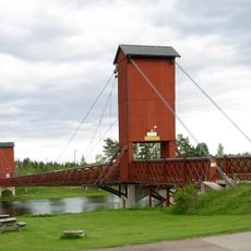
Hängbron, Dala Floda
4.1 km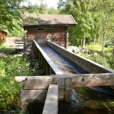
Kvarna
2.3 km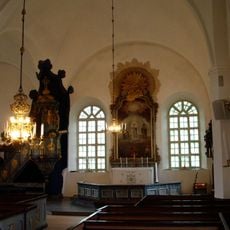
Floda Church
4 km
Närsberget
3.5 km
Storhälla
5.3 km
2004089 (W-id) En landsvägstall s.k Formärke
4.8 km
Floda 282
3.8 km
Lisslkvarna
2.3 km
Floda 303
4.5 km
Floda 317
4.1 km
Floda 376
3.7 km
Floda 251
5.4 km
Floda 318
4.4 km
Floda 295
3 km
Närsen-Grontjärns Järnväg
294 m
Floda 306
4.3 km
Hjortanders koja
3.7 km
Floda 263
4.8 km
Floda 258
5.2 km
Floda 293
3.7 km
Floda 382
3.7 km
Floda 385
3.7 km
Floda 439
3.7 km
Floda 441
3.7 km
Floda 447
3.7 km
Mosselbodarna
2.7 km
Floda 545
2.9 km
Floda gammelgård
4.4 kmReviews
Visited this place? Tap the stars to rate it and share your experience / photos with the community! Try now! You can cancel it anytime.
Discover hidden gems everywhere you go!
From secret cafés to breathtaking viewpoints, skip the crowded tourist spots and find places that match your style. Our app makes it easy with voice search, smart filtering, route optimization, and insider tips from travelers worldwide. Download now for the complete mobile experience.

A unique approach to discovering new places❞
— Le Figaro
All the places worth exploring❞
— France Info
A tailor-made excursion in just a few clicks❞
— 20 Minutes