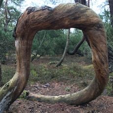
Söndrum 52:1, stone setting in Halmstad Municipality, Halland County, Sweden
Location: Halmstad Municipality
GPS coordinates: 56.69807,12.72337
Latest update: November 22, 2025 03:22
Haverdal
3 km
Möllegård
3.6 km
Vilshärad
2.6 km
Söndrum 43:2
2.2 km
Söndrum 43:1
2.2 km
Söndrum 74:1
2.4 km
Söndrum 91:1
1 km
Ringenäs skjutvarningsfyr
2.6 km
Söndrum 54:1
553 m
Söndrum 56:1
2.5 km
Söndrum 27:1
3.7 km
Söndrum 39:1
3 km
Söndrum 91:2
1 km
Söndrum 51:2
995 m
Söndrum 44:1
1.9 km
Söndrum 39:2
3 km
Söndrum 46:1
1.3 km
Söndrum 51:1
968 m
Harplinge 151:1
1.9 km
Söndrum 50:1
819 m
Söndrum 85:1
1.2 km
Harplinge 30:1
784 m
Söndrum 50:3
862 m
Kung Ägirs hög
1.3 km
Harplinge 29:1
1.7 km
Vilshärads Golfbana
2.4 km
Ringenäs Golfklubb
1.2 km
Haverdals Golfklubb
2.2 kmReviews
Visited this place? Tap the stars to rate it and share your experience / photos with the community! Try now! You can cancel it anytime.
Discover hidden gems everywhere you go!
From secret cafés to breathtaking viewpoints, skip the crowded tourist spots and find places that match your style. Our app makes it easy with voice search, smart filtering, route optimization, and insider tips from travelers worldwide. Download now for the complete mobile experience.

A unique approach to discovering new places❞
— Le Figaro
All the places worth exploring❞
— France Info
A tailor-made excursion in just a few clicks❞
— 20 Minutes