Habo 4:3, stenkrets i Västergötland
Location: Habo Municipality
GPS coordinates: 57.88573,14.05378
Latest update: November 22, 2025 12:23
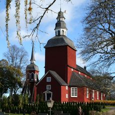
Habo Church
1.9 km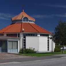
Saint John's Church
2.8 km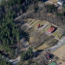
Fiskebäck
2.9 km
Fiskebäck
2.4 km
Bankeryd 3:2
2.8 km
Bankeryd 1:1
2.6 km
Bankeryd 1:2
2.6 km
Habo 268:1
193 m
Habo 4:2
12 m
Habo 50:2
782 m
Habo 49:1
967 m
Habo 4:4
11 m
Habo 318
792 m
Bankeryd 3:1
2.8 km
Habo 4:1
27 m
Bankeryd 3:3
2.8 km
Habo 3:1
752 m
Habo 180:1
2.3 km
Habo 267:1
331 m
Habo 5:1
222 m
Habo 50:1
793 m
Habo 52:1
2.2 km
Habo 198:1
1.5 km
Habo 44:1
1.8 km
Habo 48:1
877 m
Habo 340
297 m
Habo 325
1.3 km
Habo 52:2
2.2 kmReviews
Visited this place? Tap the stars to rate it and share your experience / photos with the community! Try now! You can cancel it anytime.
Discover hidden gems everywhere you go!
From secret cafés to breathtaking viewpoints, skip the crowded tourist spots and find places that match your style. Our app makes it easy with voice search, smart filtering, route optimization, and insider tips from travelers worldwide. Download now for the complete mobile experience.

A unique approach to discovering new places❞
— Le Figaro
All the places worth exploring❞
— France Info
A tailor-made excursion in just a few clicks❞
— 20 Minutes