Kånna 47:3, röse i Småland
Location: Ljungby Municipality
GPS coordinates: 56.80086,13.84288
Latest update: November 3, 2025 02:53
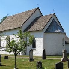
Kånna Church
4.3 km
Kånna högar
4.3 km
1) Pysslingeröset
1.9 km
Angelstad 20:1
5.7 km
Högarör
4.8 km
Angelstad 298:1
2.8 km
Angelstad 236:1
5.5 km
Angelstad 254:1
3.1 km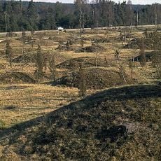
Kånna högar (nr 1)
4.3 km
Angelstad 256:5
5.1 km
Ljungby 117:1
5.9 km
Angelstad 253:1
3.5 km
Kånna 90:1
4.1 km
1) Pysslingeröset
1.9 km
Angelstad 24:2
2.3 km
Annerstad 33:1
4.2 km
Kånna 38:1
1.9 km
Kånna 48:2
1 km
Kånna 87:1
1.1 km
Kånna 87:2
1.1 km
Kånna 4:1
5.5 km
Kånna 122:1
2.1 km
Kånna 123:1
509 m
Kånna 124:1
1.2 km
Kånna 125:1
4.8 km
Ljungby 94:1
5.2 km
Angelstad 24:1
2.3 km
Svetruck Gaffeltruck
4.9 kmReviews
Visited this place? Tap the stars to rate it and share your experience / photos with the community! Try now! You can cancel it anytime.
Discover hidden gems everywhere you go!
From secret cafés to breathtaking viewpoints, skip the crowded tourist spots and find places that match your style. Our app makes it easy with voice search, smart filtering, route optimization, and insider tips from travelers worldwide. Download now for the complete mobile experience.

A unique approach to discovering new places❞
— Le Figaro
All the places worth exploring❞
— France Info
A tailor-made excursion in just a few clicks❞
— 20 Minutes