Öckerö 275:3, husgrund, historisk tid i Bohuslän
Location: Öckerö Municipality
GPS coordinates: 57.75929,11.62960
Latest update: November 20, 2025 05:22
Hyppeln
1.5 km
Rörö
2.8 km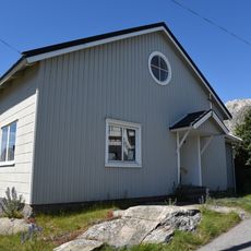
Knippla kapell
1.6 km
Jättens kammare
1.3 km
Hälsö upper light
2.8 km
Stora Oset
1.9 km
Jättens håla
1.3 km
Källö-Knipplan övre
1.6 km
Björkö lower light
2.9 km
Öckerö 120:1
3 km
Kåkholmen upper light
1.4 km
Rörö Fishing Port upper light
1.8 km
Kåkholmen lower light
1.4 km
Rörö upper light
1.5 km
Källö-Knipplan nedre
1.7 km
Rörö Fishing Port lower light
1.6 km
Öckerö 26:1
3 km
Öckerö 73:2
2.5 km
Rörö lower light
1.4 km
Öckerö 275:1
53 m
Öckerö 119:1
3 km
Öckerö 275:2
52 m
Öckerö 276:1
242 m
Öckerö 277:1
205 m
Öckerö 279:1
2.7 km
Öckerö 279:2
2.7 km
Öckerö 282:1
3.3 km
Öckerö 283:1
3.3 kmReviews
Visited this place? Tap the stars to rate it and share your experience / photos with the community! Try now! You can cancel it anytime.
Discover hidden gems everywhere you go!
From secret cafés to breathtaking viewpoints, skip the crowded tourist spots and find places that match your style. Our app makes it easy with voice search, smart filtering, route optimization, and insider tips from travelers worldwide. Download now for the complete mobile experience.

A unique approach to discovering new places❞
— Le Figaro
All the places worth exploring❞
— France Info
A tailor-made excursion in just a few clicks❞
— 20 Minutes