Erska 73:1, stenkammargrav i Västergötland
Location: Alingsås Municipality
GPS coordinates: 58.11547,12.48431
Latest update: June 15, 2024 09:11
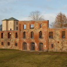
Gräfsnäs castle
4.4 km
Lagmansereds kyrkoruin
2.6 km
Erska 5:1
3.2 km
Lagmansered 12:1
4.9 km
Lagmansered 11:1
4.6 km
Gräfsnäs
3.9 km
Erska 36:1
2.1 km
Lagmansered 13:1
2.6 km
Erska 12:1
2.7 km
Stora Mellby 89:1
3.4 km
Erska 15:1
3.4 km
Erska 4:1
2.3 km
Erska 28:1
2.8 km
Erska 29:1
2.7 km
Erska 169:1
4.7 km
Erska 170:1
4.7 km
Erska 185
3.9 km
Lagmansered 8:1
4.4 km
Långared 9:1
4.7 km
Magra 44:1
4.3 km
Erska 14:1
2.6 km
Lagmansered 9:1
4.4 km
Vitevattneröset
4.5 km
Kungshögen
2.2 km
Magra 9:1
4.6 km
Magra 23:1
4.6 km
Gammelmacken i Sollebrunn
2.8 km
Stora Mellby 30:1
3.5 kmReviews
Visited this place? Tap the stars to rate it and share your experience / photos with the community! Try now! You can cancel it anytime.
Discover hidden gems everywhere you go!
From secret cafés to breathtaking viewpoints, skip the crowded tourist spots and find places that match your style. Our app makes it easy with voice search, smart filtering, route optimization, and insider tips from travelers worldwide. Download now for the complete mobile experience.

A unique approach to discovering new places❞
— Le Figaro
All the places worth exploring❞
— France Info
A tailor-made excursion in just a few clicks❞
— 20 Minutes