Od 6:1, stone setting in Herrljunga Municipality, Västra Götaland County, Sweden
Location: Herrljunga Municipality
GPS coordinates: 57.93775,13.18936
Latest update: November 21, 2025 20:42

Od 5:4
517 m
Od 10:2
1.2 km
Od 31:1
1.6 km
Od 2:3
852 m
Assars kulle
297 m
Od 10:1
1.3 km
Od 27:1
2.4 km
Od 5:1
534 m
Örkestorp
472 m
Od 5:3
525 m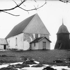
Od kyrka
622 m
Historisk vagnsamling
2.6 km
Ods gravkullar
981 m
Od 79:2
1.9 km
Od 115:1
918 m
Hägna gammelgård
2 km
Od 29:1
1.9 km
Od 12:1
853 m
Od 92:1
1 km
Ods gravkullar
1 km
Od 20:1
777 m
Od 36:1
2.1 km
Ods gravkullar
993 m
Od 90:1
497 m
Od 91:1
982 m
Od 11:1
1.2 km
Od 4:1
285 m
Od 2:1
869 mReviews
Visited this place? Tap the stars to rate it and share your experience / photos with the community! Try now! You can cancel it anytime.
Discover hidden gems everywhere you go!
From secret cafés to breathtaking viewpoints, skip the crowded tourist spots and find places that match your style. Our app makes it easy with voice search, smart filtering, route optimization, and insider tips from travelers worldwide. Download now for the complete mobile experience.

A unique approach to discovering new places❞
— Le Figaro
All the places worth exploring❞
— France Info
A tailor-made excursion in just a few clicks❞
— 20 Minutes