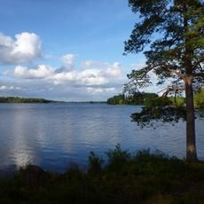
Kalv 75:1, hällristning i Västergötland
Location: Svenljunga Municipality
GPS coordinates: 57.16204,13.07025
Latest update: November 19, 2025 19:16
Fegen
5.2 km
Fegen (naturreservat, Västra Götalands län)
7.3 km
Fegen
3.6 km
Fegen
5.8 km
Gunnarp 12:1
7.6 km
Gunnarp 13:1
7.3 km
Sandvik 36:1
6 km
Kalv 2:1
4.9 km
Penningaröret
6.5 km
Gunnarp 111:1
7.6 km
Gunnarp 18:1
7.6 km
Gunnarp 29:1
7.4 km
Sandvik 7:1
5.9 km
Gunnarp 25:1
6.8 km
Gunnarp 108:1
7.4 km
Gunnarp 54:2
5.1 km
Sandvik 80
5.7 km
Gryteryd 3:1
4.9 km
Gunnarp 54:1
5.1 km
Kalv 9:1
6.2 km
Göpudden
7.2 km
Gunnarp 43:1
7.1 km
Drottningrör
6.9 km
Penningaröret
6.5 km
Penningaröret
6.5 km
Kalv 15:1
4.3 km
Sandvik 1:1
7 km
Gunnarp 57:1
5.1 kmReviews
Visited this place? Tap the stars to rate it and share your experience / photos with the community! Try now! You can cancel it anytime.
Discover hidden gems everywhere you go!
From secret cafés to breathtaking viewpoints, skip the crowded tourist spots and find places that match your style. Our app makes it easy with voice search, smart filtering, route optimization, and insider tips from travelers worldwide. Download now for the complete mobile experience.

A unique approach to discovering new places❞
— Le Figaro
All the places worth exploring❞
— France Info
A tailor-made excursion in just a few clicks❞
— 20 Minutes