Trollhättan 68:1, stone setting in Trollhättan Municipality, Älvsborg County, Sweden
Location: Trollhättan Municipality
GPS coordinates: 58.30393,12.28878
Latest update: November 22, 2025 19:58
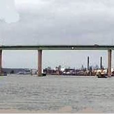
Stallbackabron
1.7 km
Ekholm
923 m
Stridsbergsbron
1.2 km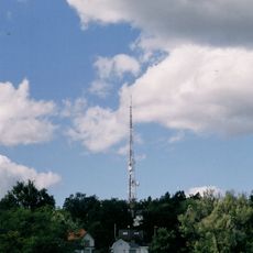
Strömslundstornet
1.7 km
Västergötlands runinskrifter 228
1.3 km
Trollhättan 83:3
1.7 km
Trollhättan 69:2
59 m
Trollhättan 258:1
697 m
Trollhättan 288
1.7 km
Trollhättan 86:1
1.7 km
Trollhättan 85:1
1.7 km
Trollhättan 83:1
1.7 km
Trollhättan 57:2
48 m
Trollhättan 69:1
81 m
Trollhättan 124:1
1.7 km
Trollhättan 28:1
104 m
Trollhättan 57:1
60 m
Trollhättan 147:1
1.8 km
Trollhättan 83:2
1.7 km
Trollhättan 55:1
443 m
Trollhättan 85:2
1.7 km
Trollhättan 81:1
1.7 km
Trollhättan 11:1
1.8 km
Trollhättan 137:1
1.8 km
Luffar-Lasse
1.1 km
Work of art, sculpture
1.7 km
Work of art
1.7 km
Work of art
1.5 kmReviews
Visited this place? Tap the stars to rate it and share your experience / photos with the community! Try now! You can cancel it anytime.
Discover hidden gems everywhere you go!
From secret cafés to breathtaking viewpoints, skip the crowded tourist spots and find places that match your style. Our app makes it easy with voice search, smart filtering, route optimization, and insider tips from travelers worldwide. Download now for the complete mobile experience.

A unique approach to discovering new places❞
— Le Figaro
All the places worth exploring❞
— France Info
A tailor-made excursion in just a few clicks❞
— 20 Minutes