Daretorp 19:1, stenkrets i Västergötland
Location: Tidaholm Municipality
GPS coordinates: 58.17708,14.09343
Latest update: November 23, 2025 22:50
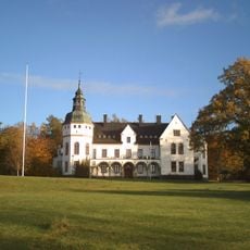
Helliden Castle
6.7 km
Hellidens folkhögskola
6.7 km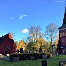
Södra Fågelås Church
7.3 km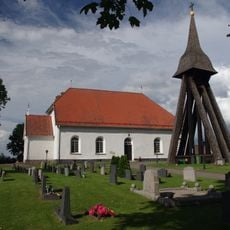
Daretorp Church
6 km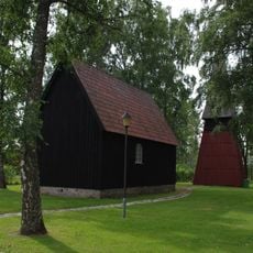
Mobackens kapell
3.2 km
Hyltan
1.6 km
Vita mossen
2.8 km
Agnetorp 77:1
3.8 km
Fröjered 53:1
6.5 km
Stadsäga 378 i Tidaholms stad
7.1 km
Fröjered 14:1
5.4 km
Hulan Daretorp
6.4 km
Fröjered 13:3
6.4 km
Fröjered 14:2
5.4 km
Wassermühle in Hjo
7.1 km
Fröjered 13:2
6.4 km
Fröjered 13:1
6.4 km
Södra Fågelås 20:1
3.5 km
Agnetorp 12:1
4.3 km
Fröjered 61:1
6.9 km
Fröjered 18:1
7.2 km
Fröjered 69:1
7.2 km
Daretorp 2:1
4.8 km
Östra kyrkogårdens kapell
7.1 km
Agnetorp 5:1
6.7 km
Agnetorp 6:1
4.2 km
Daretorp 21:1
6.6 km
Södra Fågelås kyrka
7.3 kmReviews
Visited this place? Tap the stars to rate it and share your experience / photos with the community! Try now! You can cancel it anytime.
Discover hidden gems everywhere you go!
From secret cafés to breathtaking viewpoints, skip the crowded tourist spots and find places that match your style. Our app makes it easy with voice search, smart filtering, route optimization, and insider tips from travelers worldwide. Download now for the complete mobile experience.

A unique approach to discovering new places❞
— Le Figaro
All the places worth exploring❞
— France Info
A tailor-made excursion in just a few clicks❞
— 20 Minutes