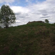
Segerstad 176:1, stenkammargrav i Västergötland
Location: Falköping Municipality
GPS coordinates: 58.23348,13.65712
Latest update: November 23, 2025 13:39
Segerstad 194:1
133 m
Valtorp 35:1
1.2 km
Södra Kyrketorp 15:1
1 km
Västergötlands runinskrifter 96
642 m
Södra Kyrketorp 33:1
461 m
Valtorp 12:2
1.4 km
Segerstad 169:1
1.4 km
Segerstad 58:1
775 m
Södra Kyrketorp 33:3
480 m
Södra Kyrketorp 33:2
449 m
Segerstad 59:1
1.1 km
Valtorp 28:1
1.3 km
Segerstad 118:1
134 m
Valtorp 34:1
1 km
Segerstad 169:4
1.4 km
Segerstad 169:2
1.4 km
Valtorp 12:1
1.4 km
Segerstad 169:3
1.4 km
Äspekullen
1.2 km
Södra Kyrketorp 14:1
1.4 km
Segerstad 60:1
1.3 km
Valtorp 15:1
1.4 km
Valtorp 14:1
1.2 km
Valtorp 13:1
1.3 km
Torbjörntorp 94:1
1.3 km
Valtorp 11:1
1.5 km
Södra Kyrketorp 13:1
1.5 km
Södra Kyrketorp 34:1
507 mReviews
Visited this place? Tap the stars to rate it and share your experience / photos with the community! Try now! You can cancel it anytime.
Discover hidden gems everywhere you go!
From secret cafés to breathtaking viewpoints, skip the crowded tourist spots and find places that match your style. Our app makes it easy with voice search, smart filtering, route optimization, and insider tips from travelers worldwide. Download now for the complete mobile experience.

A unique approach to discovering new places❞
— Le Figaro
All the places worth exploring❞
— France Info
A tailor-made excursion in just a few clicks❞
— 20 Minutes