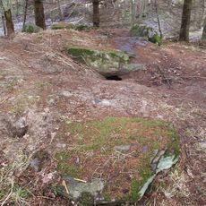
Bokenäs 439:2, hällristning i Bohuslän
Location: Uddevalla Municipality
GPS coordinates: 58.28640,11.55357
Latest update: October 26, 2025 10:40
Ganggrab von Berg
597 m
Bokenäs 29:1
1.2 km
Bokenäs 435:1
704 m
Bokenäs 436:1
807 m
Bokenäs 440:3
164 m
Bokenäs 31:1
990 m
Bokenäs 458
707 m
Bokenäs 440:1
143 m
Bokenäs 35:1
611 m
Bokenäs 3:1
1.3 km
Bokenäs 39:1
82 m
Bokenäs 459
163 m
Bokenäs 40:2
758 m
Bokenäs 457
167 m
Bokenäs 465
560 m
Bokenäs 440:2
149 m
Bokenäs 464
571 m
Bokenäs 438:1
800 m
Bokenäs 80:1
870 m
Bokenäs 85:1
784 m
Bokenäs 117:1
736 m
Bokenäs 2:1
1.2 km
Bokenäs 40:1
740 m
Bokenäs 437:1
844 m
Bokenäs 38:1
417 m
Bokenäs 34:1
1.1 km
Bokenäs 32:1
1 km
Bokenäs 30:1
1.2 kmReviews
Visited this place? Tap the stars to rate it and share your experience / photos with the community! Try now! You can cancel it anytime.
Discover hidden gems everywhere you go!
From secret cafés to breathtaking viewpoints, skip the crowded tourist spots and find places that match your style. Our app makes it easy with voice search, smart filtering, route optimization, and insider tips from travelers worldwide. Download now for the complete mobile experience.

A unique approach to discovering new places❞
— Le Figaro
All the places worth exploring❞
— France Info
A tailor-made excursion in just a few clicks❞
— 20 Minutes