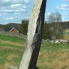
Långelanda 1:4, röse i Bohuslän
Location: Orust Municipality
GPS coordinates: 58.17330,11.76551
Latest update: October 26, 2025 17:33
Hogastenen
4.2 km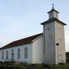
Långelanda Church
2.8 km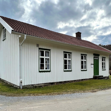
Burås school museum
4.1 km
Stala 7:2
2.8 km
Stala 93:1
3.5 km
Stala 380
4.2 km
Myckleby 53:1
4 km
Stala 15:1
4.4 km
Myckleby 88:1
3.8 km
Myckleby 85:1
3.3 km
Långelanda 279
1.5 km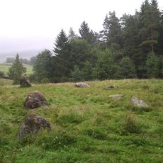
Stala 12:1
4.4 km
Myckleby 84:1
2.9 km
Långelanda 281
1.6 km
Långelanda 123:1
4.1 km
Stala 381
4.2 km
Stala 382
3.8 km
Långelanda 277
1.6 km
Stala 7:1
2.8 km
Långelanda 280
1.7 km
Långelanda 1:3
32 m
Långelanda 10:1
3.6 km
Långelanda 85:1
4.3 km
Långelanda 87:1
4.2 km
Långelanda 95:1
2.4 km
Långelanda 103:1
4.2 km
Långelanda 119:1
4.2 km
Scenic viewpoint
4.2 kmReviews
Visited this place? Tap the stars to rate it and share your experience / photos with the community! Try now! You can cancel it anytime.
Discover hidden gems everywhere you go!
From secret cafés to breathtaking viewpoints, skip the crowded tourist spots and find places that match your style. Our app makes it easy with voice search, smart filtering, route optimization, and insider tips from travelers worldwide. Download now for the complete mobile experience.

A unique approach to discovering new places❞
— Le Figaro
All the places worth exploring❞
— France Info
A tailor-made excursion in just a few clicks❞
— 20 Minutes