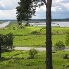
Asker 30:1, stenkrets i Närke
Location: Örebro Municipality
GPS coordinates: 59.14930,15.39481
Latest update: November 22, 2025 21:00
Kvismaren
2.3 km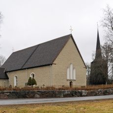
Sköllersta Church
2.9 km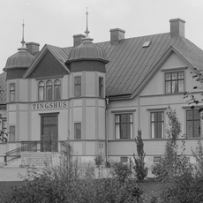
Askers och Sköllersta tingslag
3.3 km
Berga äng
1.4 km
Sköllersta prästäng
3.1 km
Sköllersta 197
3.9 km
Asker 33:1
765 m
Asker 49:1
1.3 km
Lövholmen
3.7 km
Asker 32:1
2.9 km
Sköllersta 4:1
3.6 km
Konstahögarna
711 m
Sköllersta 195
3.9 km
Sköllersta 52:1
2.4 km
Asker 50:1
1.4 km
Konstahögarna
668 m
Sköllersta 14:2
2 km
Sköllersta 10:2
2.5 km
Sköllersta 7:1
3.5 km
Asker 158
1.4 km
Ottos backe
1.7 km
Sköllersta 14:1
2.1 km
Sköllersta 11:1
2.6 km
Sköllersta 10:1
2.6 km
Sköllersta 1:1
2.6 km
Öby kulle
3.3 km
Cykelmuseum
2.3 km
Atria Lithells fabriksförsäljning
2.6 kmReviews
Visited this place? Tap the stars to rate it and share your experience / photos with the community! Try now! You can cancel it anytime.
Discover hidden gems everywhere you go!
From secret cafés to breathtaking viewpoints, skip the crowded tourist spots and find places that match your style. Our app makes it easy with voice search, smart filtering, route optimization, and insider tips from travelers worldwide. Download now for the complete mobile experience.

A unique approach to discovering new places❞
— Le Figaro
All the places worth exploring❞
— France Info
A tailor-made excursion in just a few clicks❞
— 20 Minutes