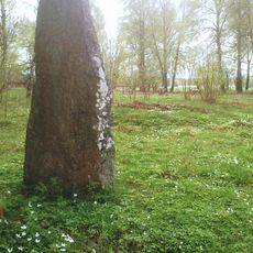
Lerbäck 472:1, röse i Närke
Location: Askersund Municipality
GPS coordinates: 58.90950,15.31025
Latest update: November 23, 2025 17:42
Glottrasten
9.2 km
Kärnskogsmossen
7.6 km
Hjärtasjöns skärgård
2.7 km
Stenön
4.6 km
Laggarfall
1.9 km
Kopparbergs äng
2.8 km
Hornrösan
1.8 km
Svennevad 16:1
8.4 km
Bo 47:1
7.8 km
Lerbäck 7:1
6.1 km
Ässböle, Hökatall, Hamra
8 km
Adventskyrkan
7.5 km
Lerbäck 23:2
6 km
Hallsberg 127:1
6.4 km
Lerbäck 468:1
3.9 km
Bo 41:2
9.2 km
Lerbäck 23:1
6 km
Lerbäck 39:1
3.7 km
Närkesbergssmedjan
3.9 km
Svennevad 17:1
8 km
Lerbäck 470:1
101 m
Lerbäck 470:6
178 m
Lerbäck 471:1
217 m
Björstorpet
652 m
Bo 41:1
9.2 km
Kristoffers kulle
6.9 km
Kristoffers röse
6.2 km
Lerbäck 37:1
3.4 kmReviews
Visited this place? Tap the stars to rate it and share your experience / photos with the community! Try now! You can cancel it anytime.
Discover hidden gems everywhere you go!
From secret cafés to breathtaking viewpoints, skip the crowded tourist spots and find places that match your style. Our app makes it easy with voice search, smart filtering, route optimization, and insider tips from travelers worldwide. Download now for the complete mobile experience.

A unique approach to discovering new places❞
— Le Figaro
All the places worth exploring❞
— France Info
A tailor-made excursion in just a few clicks❞
— 20 Minutes