Munktorp 639:4, stone setting in Västmanland, Sweden
Location: Köping Municipality
GPS coordinates: 59.65320,16.07362
Latest update: November 22, 2025 21:21

En gran
3.1 km
Munktorp 573:1
5.7 km
Sura 6:4
3.6 km
Berg 35:1
5.9 km
Odensvi 98:1
4.2 km
Nogsta skans
5.8 km
Berg 51:1
5.3 km
Berg 58:1
4.7 km
Sura 6:3
3.6 km
Odensvi 148:1
5.7 km
Sura 6:2
3.6 km
Munktorp 506:1
5.4 km
Sura 154
1.6 km
Berg 60:1
5.4 km
Berg 31:1
6 km
Sura 6:1
3.6 km
Sura 18:1
5.6 km
Sura 62:1
5.6 km
Munktorp 614:1
1.2 km
Munktorp 639:1
53 m
Munktorp 639:2
48 m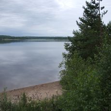
Public beach Lisjöbadet, Sörsjön
3.5 km
Munktorp 639:3
33 m
Odensvi 159:1
5.1 km
Odensvi 147:1
5.1 km
Berg 50:1
5.8 km
Hammarhagen
5.4 km
Berg 32:1
5.4 kmReviews
Visited this place? Tap the stars to rate it and share your experience / photos with the community! Try now! You can cancel it anytime.
Discover hidden gems everywhere you go!
From secret cafés to breathtaking viewpoints, skip the crowded tourist spots and find places that match your style. Our app makes it easy with voice search, smart filtering, route optimization, and insider tips from travelers worldwide. Download now for the complete mobile experience.

A unique approach to discovering new places❞
— Le Figaro
All the places worth exploring❞
— France Info
A tailor-made excursion in just a few clicks❞
— 20 Minutes