Härnösand 44:1, ristning, medeltid/historisk tid i Ångermanland
Location: Härnösand Municipality
GPS coordinates: 62.61562,18.06096
Latest update: June 15, 2024 09:33

Sjövikens havsbad
4.4 km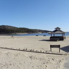
Smitingen-Härnöklubb
2.5 km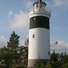
Lungö lighthouse
3.3 km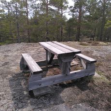
Peters platå
4.9 km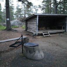
Gamla Vindskyddet
4.6 km
Public beach Härnön, Smitingens badplats
2.3 km
Härnö South lighthouse
734 m
Härnöklubb
1.8 km
Säbrå 203:1
3.4 km
Härnösand 1:1
3.5 km
Härnösand 45:1
490 m
Säbrå 203:2
3.4 km
Härnösand 4:1
2.5 km
Härnösand 45:2
462 m
Härnösand 2:1
2.7 km
Härnösand 45:3
360 m
Härnösand 5:1
3.2 km
Härnösand 68:1
5.1 km
Härnösand 65:1
5 km
Härnösand 41:1
4.7 km
Härnösand 46:1
299 m
Scenic viewpoint
2.2 km
Norra utsikten
4.4 km
Scenic viewpoint
1.5 km
Scenic viewpoint
2 km
Lotsstugan
245 m
Örsjöberget
3.2 km
Scenic viewpoint
5.1 kmReviews
Visited this place? Tap the stars to rate it and share your experience / photos with the community! Try now! You can cancel it anytime.
Discover hidden gems everywhere you go!
From secret cafés to breathtaking viewpoints, skip the crowded tourist spots and find places that match your style. Our app makes it easy with voice search, smart filtering, route optimization, and insider tips from travelers worldwide. Download now for the complete mobile experience.

A unique approach to discovering new places❞
— Le Figaro
All the places worth exploring❞
— France Info
A tailor-made excursion in just a few clicks❞
— 20 Minutes