Foss 494, hällristning i Bohuslän
Location: Munkedal Municipality
GPS coordinates: 58.48335,11.68429
Latest update: November 23, 2025 23:20
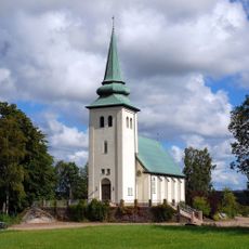
Munkedals kapell
566 m
Foss 4:1
1.3 km
Foss 322:1
765 m
Foss 318:2
984 m
Foss 213:1
666 m
Foss 224:1
1.2 km
Foss 218:1
412 m
Foss 34:1
989 m
Foss 228:1
1.2 km
Foss 307:1
1.1 km
Foss 215:1
639 m
Foss 225:1
1.2 km
Foss 225:3
1.2 km
Foss 226:1
1.3 km
Foss 206:1
1.1 km
Foss 229:1
1.2 km
Foss 229:2
1.2 km
Tjuvehögen
593 m
Foss 312:1
928 m
Foss 312:2
945 m
Foss 313:2
869 m
Foss 318:1
979 m
Foss 35:2
1.2 km
Foss 35:1
1.2 km
Foss 444
894 m
Foss 445
890 m
Foss 446
895 m
Foss 493
163 mReviews
Visited this place? Tap the stars to rate it and share your experience / photos with the community! Try now! You can cancel it anytime.
Discover hidden gems everywhere you go!
From secret cafés to breathtaking viewpoints, skip the crowded tourist spots and find places that match your style. Our app makes it easy with voice search, smart filtering, route optimization, and insider tips from travelers worldwide. Download now for the complete mobile experience.

A unique approach to discovering new places❞
— Le Figaro
All the places worth exploring❞
— France Info
A tailor-made excursion in just a few clicks❞
— 20 Minutes