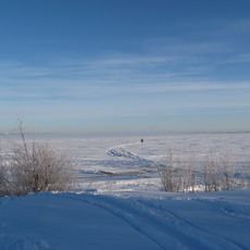
Knivskär upper light, lighthouse in Haparanda Municipality, north Bothnian coast, Sweden
Location: Haparanda Municipality
GPS coordinates: 65.68675,24.11578
Latest update: November 20, 2025 19:55
Bothnian Bay National Park
11.8 km
Torne-Furö
7 km
Koivuluodonletto
10.3 km
Kraseligrund South upper light
11.1 km
Ailinpieti fishing hut
9.7 km
Karl Johan
13.6 km
Hamnskär upper light
2.4 km
Haparandahamn lower light
13.6 km
Kraseligrund North upper light
11.1 km
Leppikarigrund lower light
11.4 km
Leppikarigrund upper light
11.5 km
Kraseli lower light
12 km
Kraseli upper light
12.1 km
Kraseli South lower light
11.5 km
Kraseligrund South lower light
11.1 km
Hamnskär lower light
1.9 km
Nikkala upper light
13.4 km
Kraseligrund North lower light
11.2 km
Haparandahamn upper light
13.5 km
Knivskär lower light
1.4 km
Nikkala lower light
13.3 km
Röytänniemi
8.5 km
Kraseli South upper light
11.4 km
Röyttän koulu
9.1 km
Puuluodon hiihtokeskus
12.7 km
Maihinnousu-muistomerkki
7.9 km
Memorial
7.9 km
Memorial
13.6 kmReviews
Visited this place? Tap the stars to rate it and share your experience / photos with the community! Try now! You can cancel it anytime.
Discover hidden gems everywhere you go!
From secret cafés to breathtaking viewpoints, skip the crowded tourist spots and find places that match your style. Our app makes it easy with voice search, smart filtering, route optimization, and insider tips from travelers worldwide. Download now for the complete mobile experience.

A unique approach to discovering new places❞
— Le Figaro
All the places worth exploring❞
— France Info
A tailor-made excursion in just a few clicks❞
— 20 Minutes