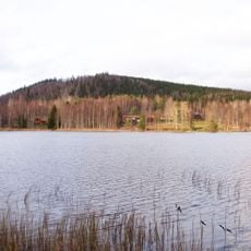
2004001 Tall, naturminne i Ludvika kommun
Location: Ludvika Municipality
Inception: October 12, 1915
GPS coordinates: 60.34838,14.99270
Latest update: June 15, 2024 11:59
Hästbergs klack
4.6 km
Tansvägga
2.4 km
Predikstolens naturreservat
1.8 km
Långmyran
2.5 km
Sågfallets fäbodar
4.4 km
Grangärde 606:1
4.4 km
Nävbodarna
1.8 km
Kastberget
4.4 km
Grangärde 121:3
4.7 km
Lindbastmora
3 km
Grangärde 123:1
4.6 km
Idtjärnsbodarna
1.4 km
Grangärde 417:1
4.1 km
Hedmans bodar
1.8 km
Idtjärnsbodarna
1.3 km
Igeltjärnstäppans fäbodar
3.4 km
Torsktjärnsberg
3.5 km
Grangärde 248:1
2.6 km
Grangärde 400:1
3.7 km
Firbodarna
4.1 km
Erik Jans Fänntjärnsbodar
2.5 km
Fänntjärnsbodarna
2.5 km
Björkåsens fäbodar
2.4 km
Grangärde 121:1
4.7 km
Lobergets fäbodar
617 m
Grangärde 64:1
1.7 km
Scenic viewpoint
3.5 km
Hästbergs klack
4.6 kmReviews
Visited this place? Tap the stars to rate it and share your experience / photos with the community! Try now! You can cancel it anytime.
Discover hidden gems everywhere you go!
From secret cafés to breathtaking viewpoints, skip the crowded tourist spots and find places that match your style. Our app makes it easy with voice search, smart filtering, route optimization, and insider tips from travelers worldwide. Download now for the complete mobile experience.

A unique approach to discovering new places❞
— Le Figaro
All the places worth exploring❞
— France Info
A tailor-made excursion in just a few clicks❞
— 20 Minutes