Sjötorp public beach, Public beach in the harbor of Sjötorp in Mariestad municipality
Location: Mariestad Municipality
Made from material: sand
GPS coordinates: 58.83870,13.97262
Latest update: March 21, 2025 08:14
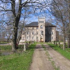
Börstorp Castle
4.4 km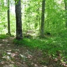
Surö bokskog
2.6 km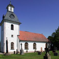
Enåsa Church
5 km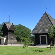
Sjötorps kyrka
939 m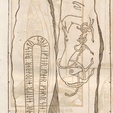
Västergötlands runinskrifter 14
4.7 km
Furnäsudde domänreservat
4.8 km
Hassle 18:1
7.5 km
Lyrestad 83:1
915 m
Bornäsudde
6 km
Harnäsudde upper light
1.2 km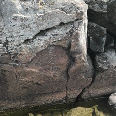
Lyrestad 84:1
365 m
Hassle 18:2
7.5 km
Sjötorp lower light
111 m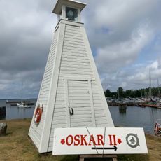
Sjötorp upper light
227 m
Harnäsudde lower light
1.2 km
Borängs borg
6.3 km
Lyrestad 220
5.9 km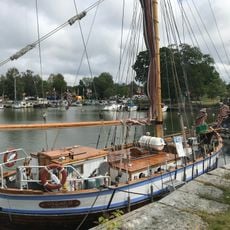
Föreningen Slupen med Oskar II
489 m
Kung Runes grav
5.5 km
Hassle 27:1
4.8 km
Sjötorp Kanalmuseum
496 m
Kung Runes grav
5.5 km
Lyrestad 95:1
5.6 km
Lyrestad 75:1
6.3 km
Surö bokskog (Naturreserv
2.5 km
Hassle 48:1
6.7 km
Hassle 20:1
6.7 km
Enåsa 1:1
4.2 kmReviews
Visited this place? Tap the stars to rate it and share your experience / photos with the community! Try now! You can cancel it anytime.
Discover hidden gems everywhere you go!
From secret cafés to breathtaking viewpoints, skip the crowded tourist spots and find places that match your style. Our app makes it easy with voice search, smart filtering, route optimization, and insider tips from travelers worldwide. Download now for the complete mobile experience.

A unique approach to discovering new places❞
— Le Figaro
All the places worth exploring❞
— France Info
A tailor-made excursion in just a few clicks❞
— 20 Minutes